You are here: Home > Network List > TA - USArray Transportable Network (new EarthScope stations) Stations List
> Station J01D Myrtle Point, OR, USA > Earthquake Result Viewer
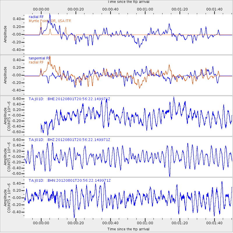
J01D Myrtle Point, OR, USA - Earthquake Result Viewer
*The percent match for this event was below the threshold and hence no stack was calculated.
| Earthquake location: |
Near N Coast Of New Guinea, P.N.G. |
| Earthquake latitude/longitude: |
-4.4/144.6 |
| Earthquake time(UTC): |
2012/08/01 (214) 20:43:40 GMT |
| Earthquake Depth: |
49 km |
| Earthquake Magnitude: |
5.6 MB, 5.4 MW |
| Earthquake Catalog/Contributor: |
WHDF/NEIC |
|
| Network: |
TA USArray Transportable Network (new EarthScope stations) |
| Station: |
J01D Myrtle Point, OR, USA |
| Lat/Lon: |
43.16 N/123.93 W |
| Elevation: |
131 m |
|
| Distance: |
94.0 deg |
| Az: |
47.163 deg |
| Baz: |
267.778 deg |
| Ray Param: |
$rayparam |
*The percent match for this event was below the threshold and hence was not used in the summary stack. |
|
| Radial Match: |
34.10164 % |
| Radial Bump: |
400 |
| Transverse Match: |
39.020096 % |
| Transverse Bump: |
400 |
| SOD ConfigId: |
469095 |
| Insert Time: |
2013-02-22 02:51:23.270 +0000 |
| GWidth: |
2.5 |
| Max Bumps: |
400 |
| Tol: |
0.001 |
|
Signal To Noise
| Channel | StoN | STA | LTA |
| TA:J01D: :BHZ:20120801T20:56:22.149971Z | 1.6283678 | 2.6620805E-7 | 1.6348153E-7 |
| TA:J01D: :BHN:20120801T20:56:22.149971Z | 1.3236779 | 2.2391151E-7 | 1.6915861E-7 |
| TA:J01D: :BHE:20120801T20:56:22.149971Z | 1.0986423 | 2.5771854E-7 | 2.3457909E-7 |
| Arrivals |
| Ps | |
| PpPs | |
| PsPs/PpSs | |


