
TAM Tamanrasset, Algeria - Earthquake Result Viewer
| ||||||||||||||||||
| ||||||||||||||||||
| ||||||||||||||||||
|
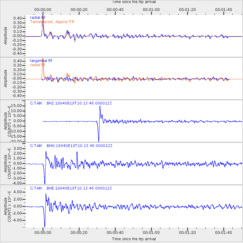
Signal To Noise
| Channel | StoN | STA | LTA |
| G:TAM: :BHN:19940819T10:13:46.000012Z | 37.465137 | 1.4345055E-6 | 3.8289073E-8 |
| G:TAM: :BHE:19940819T10:13:46.000012Z | 42.530796 | 2.05438E-6 | 4.830335E-8 |
| G:TAM: :BHZ:19940819T10:13:46.000012Z | 121.85939 | 7.1126583E-6 | 5.836775E-8 |
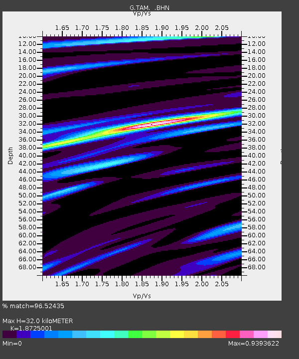
| Arrivals | |
| Ps | 4.3 SECOND |
| PpPs | 14 SECOND |
| PsPs/PpSs | 18 SECOND |

