You are here: Home > Network List > TA - USArray Transportable Network (new EarthScope stations) Stations List
> Station J04D Umpqua National Forest, Toketee, OR, USA > Earthquake Result Viewer
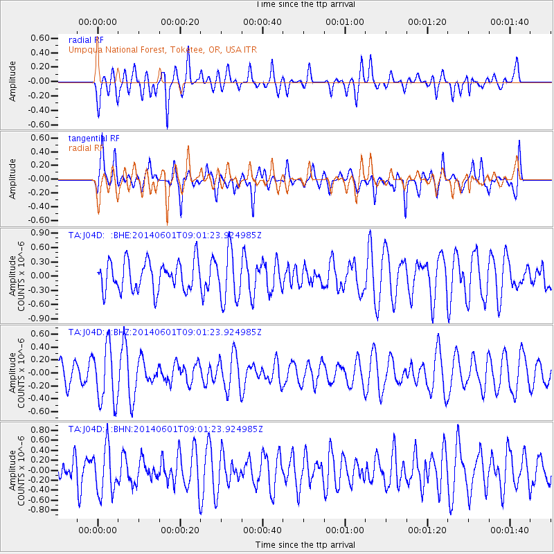
J04D Umpqua National Forest, Toketee, OR, USA - Earthquake Result Viewer
*The percent match for this event was below the threshold and hence no stack was calculated.
| Earthquake location: |
Laptev Sea |
| Earthquake latitude/longitude: |
75.0/133.6 |
| Earthquake time(UTC): |
2014/06/01 (152) 08:52:43 GMT |
| Earthquake Depth: |
10 km |
| Earthquake Magnitude: |
4.7 mb |
| Earthquake Catalog/Contributor: |
ISC/ISC |
|
| Network: |
TA USArray Transportable Network (new EarthScope stations) |
| Station: |
J04D Umpqua National Forest, Toketee, OR, USA |
| Lat/Lon: |
43.24 N/122.11 W |
| Elevation: |
1948 m |
|
| Distance: |
52.2 deg |
| Az: |
63.615 deg |
| Baz: |
341.401 deg |
| Ray Param: |
$rayparam |
*The percent match for this event was below the threshold and hence was not used in the summary stack. |
|
| Radial Match: |
66.77199 % |
| Radial Bump: |
400 |
| Transverse Match: |
62.582684 % |
| Transverse Bump: |
400 |
| SOD ConfigId: |
3390531 |
| Insert Time: |
2019-04-12 03:31:43.710 +0000 |
| GWidth: |
2.5 |
| Max Bumps: |
400 |
| Tol: |
0.001 |
|
Signal To Noise
| Channel | StoN | STA | LTA |
| TA:J04D: :BHZ:20140601T09:01:23.924985Z | 2.9850545 | 4.4568537E-7 | 1.4930562E-7 |
| TA:J04D: :BHN:20140601T09:01:23.924985Z | 2.0659502 | 4.7512177E-7 | 2.2997735E-7 |
| TA:J04D: :BHE:20140601T09:01:23.924985Z | 1.7200823 | 5.2985223E-7 | 3.080389E-7 |
| Arrivals |
| Ps | |
| PpPs | |
| PsPs/PpSs | |


