You are here: Home > Network List > US - United States National Seismic Network Stations List
> Station AMTX Amarillo, Texas, USA > Earthquake Result Viewer
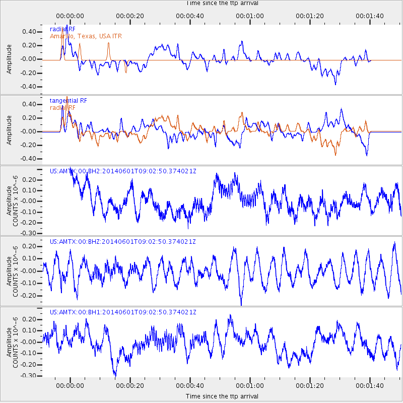
AMTX Amarillo, Texas, USA - Earthquake Result Viewer
*The percent match for this event was below the threshold and hence no stack was calculated.
| Earthquake location: |
Laptev Sea |
| Earthquake latitude/longitude: |
75.0/133.6 |
| Earthquake time(UTC): |
2014/06/01 (152) 08:52:43 GMT |
| Earthquake Depth: |
10 km |
| Earthquake Magnitude: |
4.7 mb |
| Earthquake Catalog/Contributor: |
ISC/ISC |
|
| Network: |
US United States National Seismic Network |
| Station: |
AMTX Amarillo, Texas, USA |
| Lat/Lon: |
34.53 N/101.41 W |
| Elevation: |
1010 m |
|
| Distance: |
65.1 deg |
| Az: |
48.268 deg |
| Baz: |
346.398 deg |
| Ray Param: |
$rayparam |
*The percent match for this event was below the threshold and hence was not used in the summary stack. |
|
| Radial Match: |
31.711275 % |
| Radial Bump: |
400 |
| Transverse Match: |
34.6212 % |
| Transverse Bump: |
400 |
| SOD ConfigId: |
3390531 |
| Insert Time: |
2019-04-12 03:32:52.406 +0000 |
| GWidth: |
2.5 |
| Max Bumps: |
400 |
| Tol: |
0.001 |
|
Signal To Noise
| Channel | StoN | STA | LTA |
| US:AMTX:00:BHZ:20140601T09:02:50.374021Z | 1.4556252 | 1.0954844E-7 | 7.525868E-8 |
| US:AMTX:00:BH1:20140601T09:02:50.374021Z | 1.2373554 | 8.992404E-8 | 7.267438E-8 |
| US:AMTX:00:BH2:20140601T09:02:50.374021Z | 1.1632913 | 1.1794008E-7 | 1.0138482E-7 |
| Arrivals |
| Ps | |
| PpPs | |
| PsPs/PpSs | |


