
TAM Tamanrasset, Algeria - Earthquake Result Viewer
| ||||||||||||||||||
| ||||||||||||||||||
| ||||||||||||||||||
|
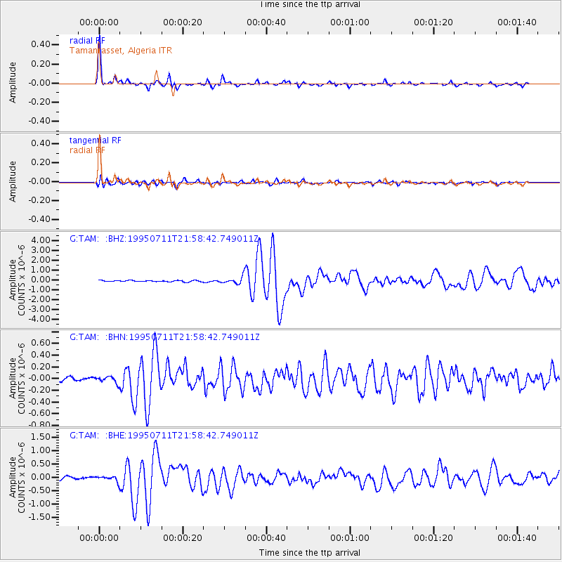
Signal To Noise
| Channel | StoN | STA | LTA |
| G:TAM: :BHN:19950711T21:58:42.749011Z | 1.709825 | 5.7674992E-8 | 3.3731517E-8 |
| G:TAM: :BHE:19950711T21:58:42.749011Z | 1.8198447 | 1.0604087E-7 | 5.826919E-8 |
| G:TAM: :BHZ:19950711T21:58:42.749011Z | 5.9734697 | 3.791832E-7 | 6.3477884E-8 |
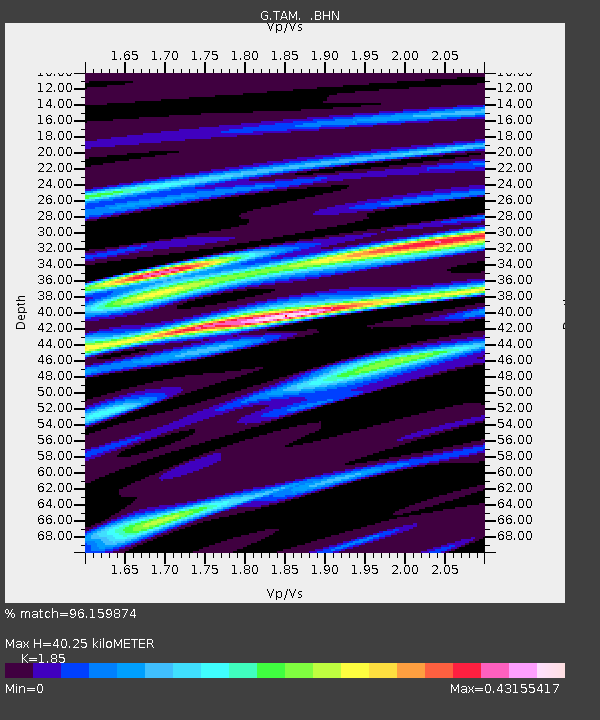
| Arrivals | |
| Ps | 5.3 SECOND |
| PpPs | 17 SECOND |
| PsPs/PpSs | 22 SECOND |

