
TAM Tamanrasset, Algeria - Earthquake Result Viewer
| ||||||||||||||||||
| ||||||||||||||||||
| ||||||||||||||||||
|
Signal To Noise
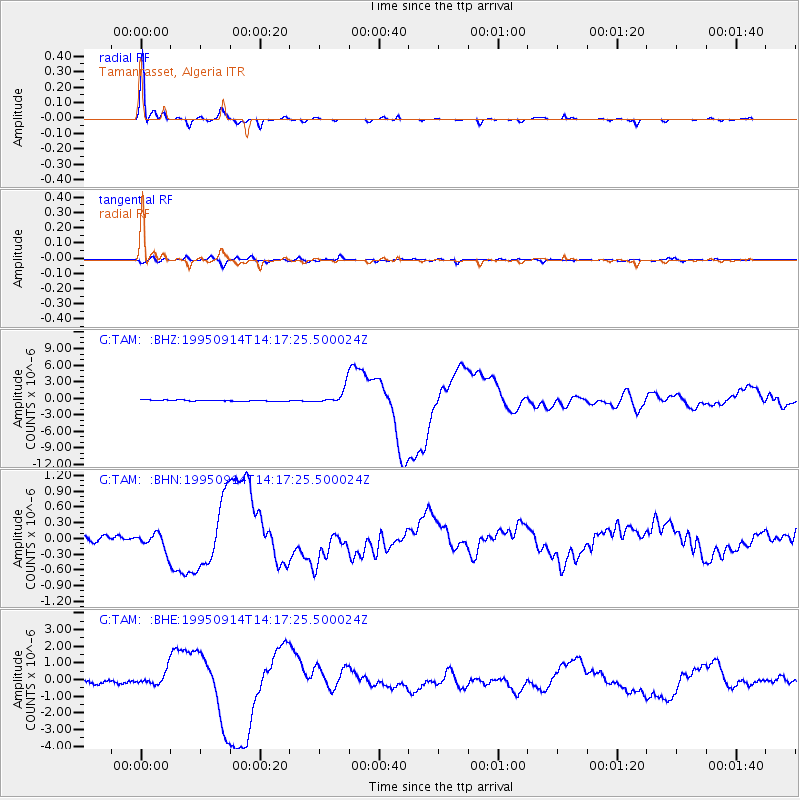
| Channel | StoN | STA | LTA |
| G:TAM: :BHN:19950914T14:17:25.500024Z | 2.8050177 | 1.7202612E-7 | 6.1327995E-8 |
| G:TAM: :BHE:19950914T14:17:25.500024Z | 4.8730373 | 4.4098624E-7 | 9.049515E-8 |
| G:TAM: :BHZ:19950914T14:17:25.500024Z | 14.048996 | 1.4817629E-6 | 1.0547109E-7 |
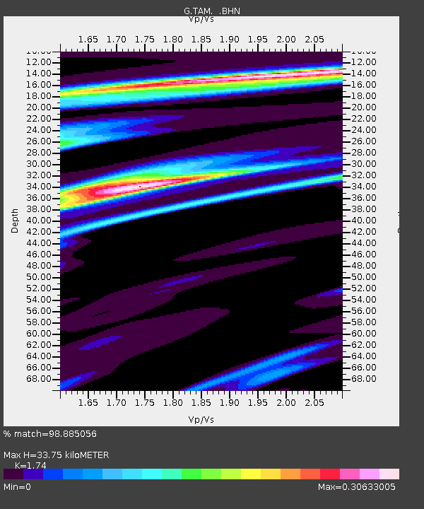
| Arrivals | |
| Ps | 3.9 SECOND |
| PpPs | 14 SECOND |
| PsPs/PpSs | 18 SECOND |

