
TAM Tamanrasset, Algeria - Earthquake Result Viewer
| ||||||||||||||||||
| ||||||||||||||||||
| ||||||||||||||||||
|
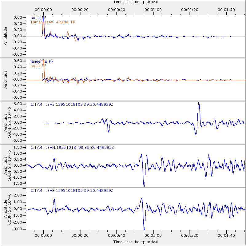
Signal To Noise
| Channel | StoN | STA | LTA |
| G:TAM: :BHN:19951018T09:39:30.448999Z | 2.0385687 | 1.6097894E-7 | 7.896666E-8 |
| G:TAM: :BHE:19951018T09:39:30.448999Z | 5.2116833 | 3.6315572E-7 | 6.968108E-8 |
| G:TAM: :BHZ:19951018T09:39:30.448999Z | 6.863047 | 6.3559565E-7 | 9.261129E-8 |
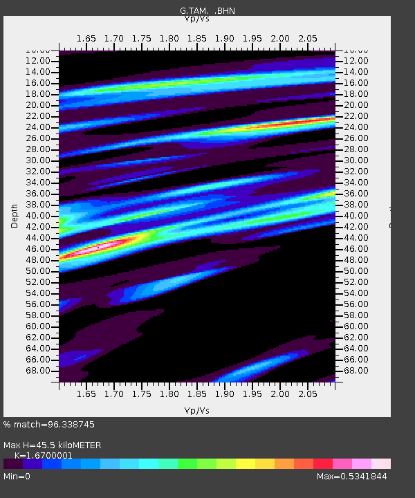
| Arrivals | |
| Ps | 4.9 SECOND |
| PpPs | 17 SECOND |
| PsPs/PpSs | 22 SECOND |

