You are here: Home > Network List > TA - USArray Transportable Network (new EarthScope stations) Stations List
> Station L04D Klamath Falls, OR, USA > Earthquake Result Viewer
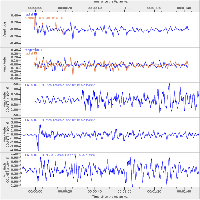
L04D Klamath Falls, OR, USA - Earthquake Result Viewer
*The percent match for this event was below the threshold and hence no stack was calculated.
| Earthquake location: |
Peru-Brazil Border Region |
| Earthquake latitude/longitude: |
-8.4/-74.3 |
| Earthquake time(UTC): |
2012/08/02 (215) 09:38:30 GMT |
| Earthquake Depth: |
145 km |
| Earthquake Magnitude: |
5.9 MB, 6.1 MW, 6.1 MW |
| Earthquake Catalog/Contributor: |
WHDF/NEIC |
|
| Network: |
TA USArray Transportable Network (new EarthScope stations) |
| Station: |
L04D Klamath Falls, OR, USA |
| Lat/Lon: |
42.22 N/122.30 W |
| Elevation: |
1437 m |
|
| Distance: |
66.8 deg |
| Az: |
323.055 deg |
| Baz: |
126.818 deg |
| Ray Param: |
$rayparam |
*The percent match for this event was below the threshold and hence was not used in the summary stack. |
|
| Radial Match: |
78.25651 % |
| Radial Bump: |
400 |
| Transverse Match: |
68.99193 % |
| Transverse Bump: |
397 |
| SOD ConfigId: |
469095 |
| Insert Time: |
2013-02-22 03:14:24.441 +0000 |
| GWidth: |
2.5 |
| Max Bumps: |
400 |
| Tol: |
0.001 |
|
Signal To Noise
| Channel | StoN | STA | LTA |
| TA:L04D: :BHZ:20120802T09:48:36.024988Z | 14.239597 | 1.5482734E-6 | 1.08730134E-7 |
| TA:L04D: :BHN:20120802T09:48:36.024988Z | 3.6953082 | 4.5821847E-7 | 1.2400007E-7 |
| TA:L04D: :BHE:20120802T09:48:36.024988Z | 2.0227034 | 4.2450634E-7 | 2.0987079E-7 |
| Arrivals |
| Ps | |
| PpPs | |
| PsPs/PpSs | |


