You are here: Home > Network List > TA - USArray Transportable Network (new EarthScope stations) Stations List
> Station H36A Jessenland, Henderson, MN, USA > Earthquake Result Viewer
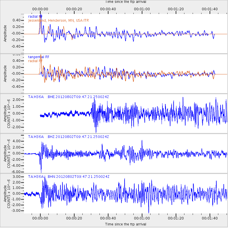
H36A Jessenland, Henderson, MN, USA - Earthquake Result Viewer
*The percent match for this event was below the threshold and hence no stack was calculated.
| Earthquake location: |
Peru-Brazil Border Region |
| Earthquake latitude/longitude: |
-8.4/-74.3 |
| Earthquake time(UTC): |
2012/08/02 (215) 09:38:30 GMT |
| Earthquake Depth: |
145 km |
| Earthquake Magnitude: |
5.9 MB, 6.1 MW, 6.1 MW |
| Earthquake Catalog/Contributor: |
WHDF/NEIC |
|
| Network: |
TA USArray Transportable Network (new EarthScope stations) |
| Station: |
H36A Jessenland, Henderson, MN, USA |
| Lat/Lon: |
44.58 N/93.93 W |
| Elevation: |
311 m |
|
| Distance: |
55.7 deg |
| Az: |
343.063 deg |
| Baz: |
156.214 deg |
| Ray Param: |
$rayparam |
*The percent match for this event was below the threshold and hence was not used in the summary stack. |
|
| Radial Match: |
76.06216 % |
| Radial Bump: |
400 |
| Transverse Match: |
71.42985 % |
| Transverse Bump: |
400 |
| SOD ConfigId: |
469095 |
| Insert Time: |
2013-02-22 03:16:34.104 +0000 |
| GWidth: |
2.5 |
| Max Bumps: |
400 |
| Tol: |
0.001 |
|
Signal To Noise
| Channel | StoN | STA | LTA |
| TA:H36A: :BHZ:20120802T09:47:21.250024Z | 27.954803 | 2.0102032E-6 | 7.190904E-8 |
| TA:H36A: :BHN:20120802T09:47:21.250024Z | 6.9940553 | 1.3269705E-6 | 1.8972834E-7 |
| TA:H36A: :BHE:20120802T09:47:21.250024Z | 4.8602424 | 1.0302755E-6 | 2.1198028E-7 |
| Arrivals |
| Ps | |
| PpPs | |
| PsPs/PpSs | |


