
TAM Tamanrasset, Algeria - Earthquake Result Viewer
| ||||||||||||||||||
| ||||||||||||||||||
| ||||||||||||||||||
|
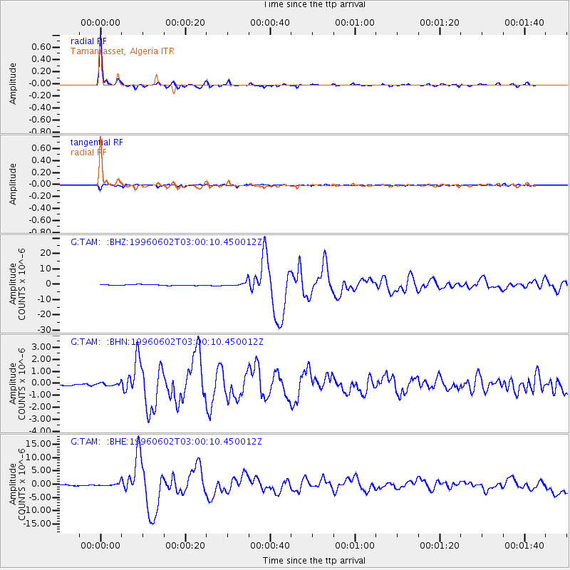
Signal To Noise
| Channel | StoN | STA | LTA |
| G:TAM: :BHN:19960602T03:00:10.450012Z | 1.0994215 | 1.2601978E-7 | 1.1462373E-7 |
| G:TAM: :BHE:19960602T03:00:10.450012Z | 3.2058282 | 6.3053756E-7 | 1.9668475E-7 |
| G:TAM: :BHZ:19960602T03:00:10.450012Z | 6.287126 | 1.6310657E-6 | 2.5942947E-7 |
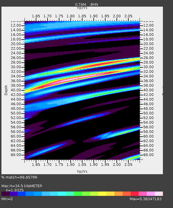
| Arrivals | |
| Ps | 4.6 SECOND |
| PpPs | 14 SECOND |
| PsPs/PpSs | 19 SECOND |

