You are here: Home > Network List > TA - USArray Transportable Network (new EarthScope stations) Stations List
> Station 242A Grayson, LA, USA > Earthquake Result Viewer
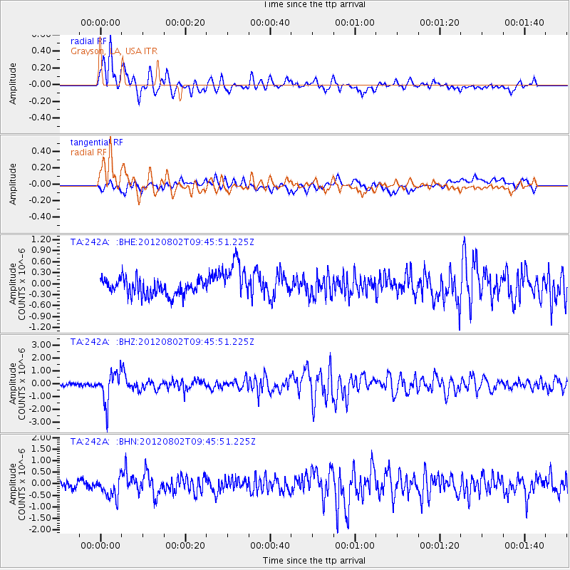
242A Grayson, LA, USA - Earthquake Result Viewer
*The percent match for this event was below the threshold and hence no stack was calculated.
| Earthquake location: |
Peru-Brazil Border Region |
| Earthquake latitude/longitude: |
-8.4/-74.3 |
| Earthquake time(UTC): |
2012/08/02 (215) 09:38:30 GMT |
| Earthquake Depth: |
145 km |
| Earthquake Magnitude: |
5.9 MB, 6.1 MW, 6.1 MW |
| Earthquake Catalog/Contributor: |
WHDF/NEIC |
|
| Network: |
TA USArray Transportable Network (new EarthScope stations) |
| Station: |
242A Grayson, LA, USA |
| Lat/Lon: |
32.06 N/92.15 W |
| Elevation: |
57 m |
|
| Distance: |
43.7 deg |
| Az: |
337.827 deg |
| Baz: |
153.911 deg |
| Ray Param: |
$rayparam |
*The percent match for this event was below the threshold and hence was not used in the summary stack. |
|
| Radial Match: |
82.9042 % |
| Radial Bump: |
400 |
| Transverse Match: |
63.552635 % |
| Transverse Bump: |
400 |
| SOD ConfigId: |
469095 |
| Insert Time: |
2013-02-22 03:21:52.891 +0000 |
| GWidth: |
2.5 |
| Max Bumps: |
400 |
| Tol: |
0.001 |
|
Signal To Noise
| Channel | StoN | STA | LTA |
| TA:242A: :BHZ:20120802T09:45:51.225Z | 13.030846 | 1.2235204E-6 | 9.3894165E-8 |
| TA:242A: :BHN:20120802T09:45:51.225Z | 3.110721 | 4.4731058E-7 | 1.4379643E-7 |
| TA:242A: :BHE:20120802T09:45:51.225Z | 2.5916977 | 5.5267964E-7 | 2.1325003E-7 |
| Arrivals |
| Ps | |
| PpPs | |
| PsPs/PpSs | |


