TAM Tamanrasset, Algeria - Earthquake Result Viewer
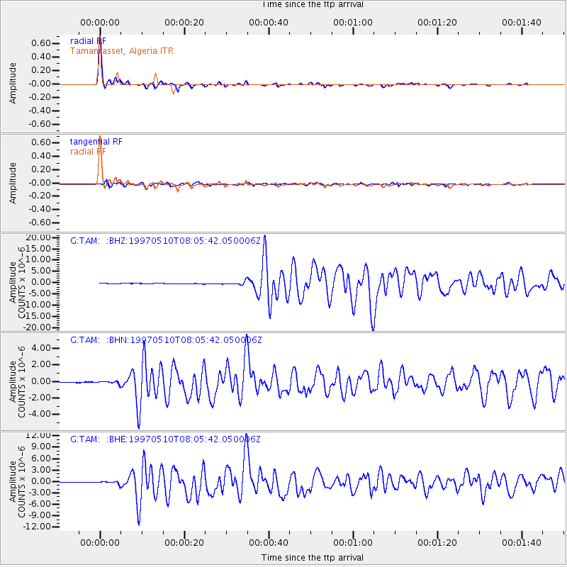
Earthquake location: Northern And Central Iran
Earthquake latitude/longitude: 33.8/59.8
Earthquake time(UTC): 1997/05/10 (130) 07:57:29 GMT
Earthquake Depth: 10 km
Earthquake Magnitude: 6.4 MB, 7.3 MS, 7.5 UNKNOWN, 7.2 MW
Earthquake Catalog/Contributor: WHDF/NEIC
Network: G GEOSCOPE
Station: TAM Tamanrasset, Algeria
Lat/Lon: 22.79 N/5.53 E
Elevation: 1377 m
Distance: 48.6 deg
Az: 271.691 deg
Baz: 64.378 deg
Ray Param: 0.06928429
Estimated Moho Depth: 40.0 km
Estimated Crust Vp/Vs: 1.60
Assumed Crust Vp: 6.61 km/s
Estimated Crust Vs: 4.131 km/s
Estimated Crust Poisson's Ratio: 0.18
Radial Match: 98.49968 %
Radial Bump: 209
Transverse Match: 88.69374 %
Transverse Bump: 400
SOD ConfigId: 6273
Insert Time: 2010-02-27 00:29:48.904 +0000
GWidth: 2.5
Max Bumps: 400
Tol: 0.001

Signal To Noise

ChannelStoNSTALTA
G:TAM: :BHN:19970510T08:05:42.050006Z3.36538821.379409E-74.098811E-8
G:TAM: :BHE:19970510T08:05:42.050006Z8.5308143.498013E-74.1004448E-8
G:TAM: :BHZ:19970510T08:05:42.050006Z8.292037.3450974E-78.858021E-8
Arrivals
Ps3.9 SECOND
PpPs15 SECOND
PsPs/PpSs19 SECOND