
TAM Tamanrasset, Algeria - Earthquake Result Viewer
| ||||||||||||||||||
| ||||||||||||||||||
| ||||||||||||||||||
|
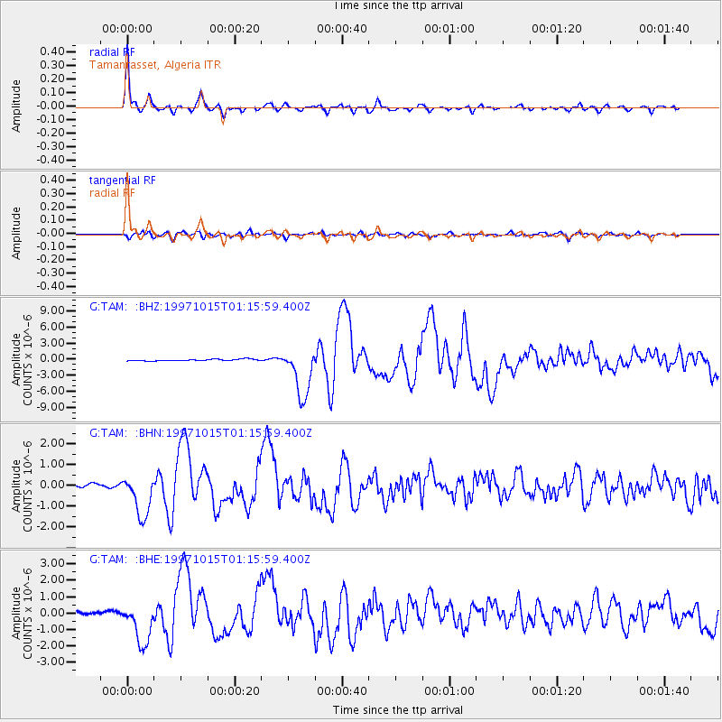
Signal To Noise
| Channel | StoN | STA | LTA |
| G:TAM: :BHN:19971015T01:15:59.400Z | 15.022437 | 1.0249274E-6 | 6.822644E-8 |
| G:TAM: :BHE:19971015T01:15:59.400Z | 18.021246 | 1.3181007E-6 | 7.314148E-8 |
| G:TAM: :BHZ:19971015T01:15:59.400Z | 31.180397 | 4.7242274E-6 | 1.5151274E-7 |
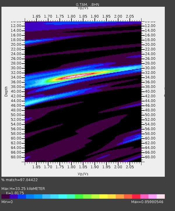
| Arrivals | |
| Ps | 4.2 SECOND |
| PpPs | 14 SECOND |
| PsPs/PpSs | 18 SECOND |

