
TAM Tamanrasset, Algeria - Earthquake Result Viewer
| ||||||||||||||||||
| ||||||||||||||||||
| ||||||||||||||||||
|
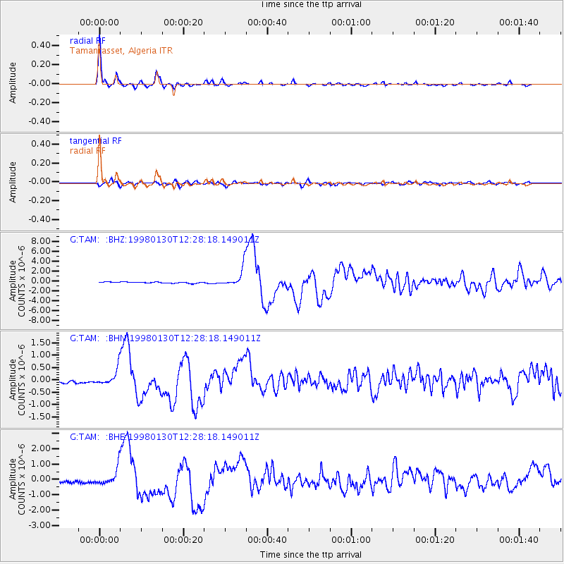
Signal To Noise
| Channel | StoN | STA | LTA |
| G:TAM: :BHN:19980130T12:28:18.149011Z | 6.232915 | 3.4370328E-7 | 5.5143264E-8 |
| G:TAM: :BHE:19980130T12:28:18.149011Z | 7.444752 | 5.8084083E-7 | 7.8020165E-8 |
| G:TAM: :BHZ:19980130T12:28:18.149011Z | 17.48041 | 2.0099103E-6 | 1.14980736E-7 |
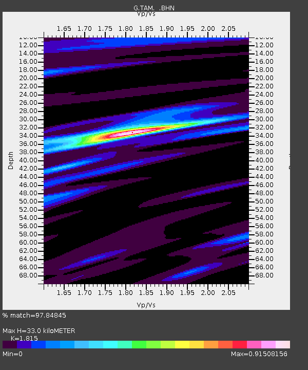
| Arrivals | |
| Ps | 4.2 SECOND |
| PpPs | 14 SECOND |
| PsPs/PpSs | 18 SECOND |

