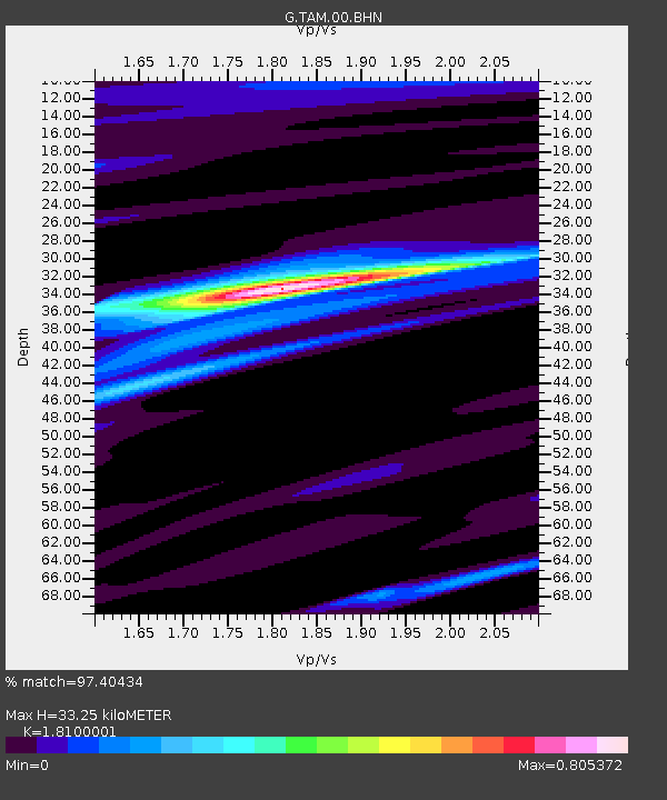
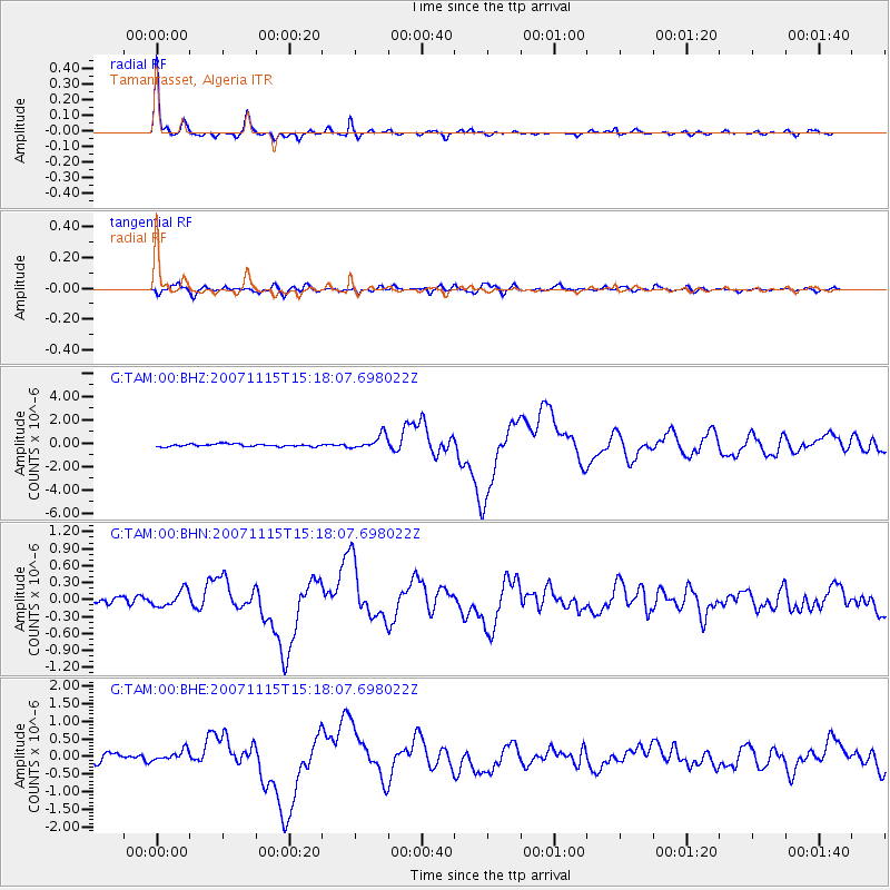
TAM Tamanrasset, Algeria - Earthquake Result Viewer

Earthquake location: Near Coast Of Northern Chile
Earthquake latitude/longitude: -22.9/-70.2
Earthquake time(UTC): 2007/11/15 (319) 15:05:58 GMT
Earthquake Depth: 26 km
Earthquake Magnitude: 6.1 MB, 6.6 MS, 6.8 MW, 6.6 MW
Earthquake Catalog/Contributor: WHDF/NEIC
Network: G GEOSCOPE
Station: TAM Tamanrasset, Algeria
Lat/Lon: 22.79 N/5.53 E
Elevation: 1377 m
Distance: 86.6 deg
Az: 63.653 deg
Baz: 243.541 deg
Ray Param: 0.04393653
Estimated Moho Depth: 33.25 km
Estimated Crust Vp/Vs: 1.81
Assumed Crust Vp: 6.61 km/s
Estimated Crust Vs: 3.652 km/s
Estimated Crust Poisson's Ratio: 0.28
Radial Match: 97.40434 %
Radial Bump: 236
Transverse Match: 80.58528 %
Transverse Bump: 400
SOD ConfigId: 2564
Insert Time: 2010-02-27 00:30:35.041 +0000
GWidth: 2.5
Max Bumps: 400
Tol: 0.001

Signal To Noise

ChannelStoNSTALTA
G:TAM:00:BHN:20071115T15:18:07.698022Z1.9077361.4246363E-77.467681E-8
G:TAM:00:BHE:20071115T15:18:07.698022Z1.47083991.5496383E-71.0535738E-7
G:TAM:00:BHZ:20071115T15:18:07.698022Z5.6426386.207187E-71.1000505E-7
Arrivals
Ps4.2 SECOND
PpPs14 SECOND
PsPs/PpSs18 SECOND