
TAM Tamanrasset, Algeria - Earthquake Result Viewer
| ||||||||||||||||||
| ||||||||||||||||||
| ||||||||||||||||||
|
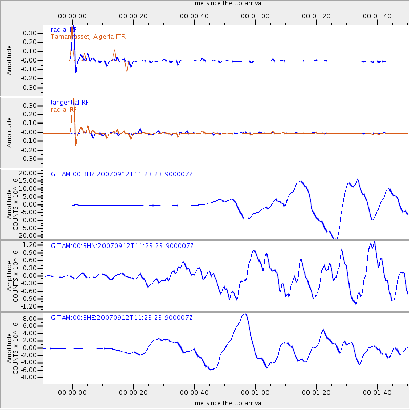
Signal To Noise
| Channel | StoN | STA | LTA |
| G:TAM:00:BHN:20070912T11:23:23.900007Z | 1.1320668 | 7.1145976E-8 | 6.284609E-8 |
| G:TAM:00:BHE:20070912T11:23:23.900007Z | 2.0710764 | 1.232285E-7 | 5.949974E-8 |
| G:TAM:00:BHZ:20070912T11:23:23.900007Z | 2.6105776 | 2.3836746E-7 | 9.1308316E-8 |
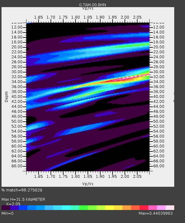
| Arrivals | |
| Ps | 5.1 SECOND |
| PpPs | 14 SECOND |
| PsPs/PpSs | 19 SECOND |

