You are here: Home > Network List > TA - USArray Transportable Network (new EarthScope stations) Stations List
> Station TOLK Toolik Lake Research Station, AK, USA > Earthquake Result Viewer
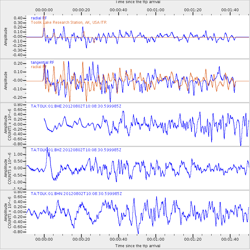
TOLK Toolik Lake Research Station, AK, USA - Earthquake Result Viewer
*The percent match for this event was below the threshold and hence no stack was calculated.
| Earthquake location: |
New Ireland Region, P.N.G. |
| Earthquake latitude/longitude: |
-4.7/153.3 |
| Earthquake time(UTC): |
2012/08/02 (215) 09:56:41 GMT |
| Earthquake Depth: |
46 km |
| Earthquake Magnitude: |
5.8 MB, 5.7 MS, 6.1 MW, 6.1 MW |
| Earthquake Catalog/Contributor: |
WHDF/NEIC |
|
| Network: |
TA USArray Transportable Network (new EarthScope stations) |
| Station: |
TOLK Toolik Lake Research Station, AK, USA |
| Lat/Lon: |
68.64 N/149.57 W |
| Elevation: |
760 m |
|
| Distance: |
82.9 deg |
| Az: |
18.067 deg |
| Baz: |
237.543 deg |
| Ray Param: |
$rayparam |
*The percent match for this event was below the threshold and hence was not used in the summary stack. |
|
| Radial Match: |
68.08076 % |
| Radial Bump: |
400 |
| Transverse Match: |
75.805435 % |
| Transverse Bump: |
400 |
| SOD ConfigId: |
469095 |
| Insert Time: |
2013-02-22 04:01:22.028 +0000 |
| GWidth: |
2.5 |
| Max Bumps: |
400 |
| Tol: |
0.001 |
|
Signal To Noise
| Channel | StoN | STA | LTA |
| TA:TOLK:01:BHZ:20120802T10:08:30.599985Z | 6.1559615 | 6.8234664E-7 | 1.1084323E-7 |
| TA:TOLK:01:BHN:20120802T10:08:30.599985Z | 1.3146069 | 1.164469E-7 | 8.8579256E-8 |
| TA:TOLK:01:BHE:20120802T10:08:30.599985Z | 1.2044522 | 1.6809472E-7 | 1.3956114E-7 |
| Arrivals |
| Ps | |
| PpPs | |
| PsPs/PpSs | |


