You are here: Home > Network List > UW - Pacific Northwest Regional Seismic Network Stations List
> Station LEBA Lebam, WA, USA > Earthquake Result Viewer
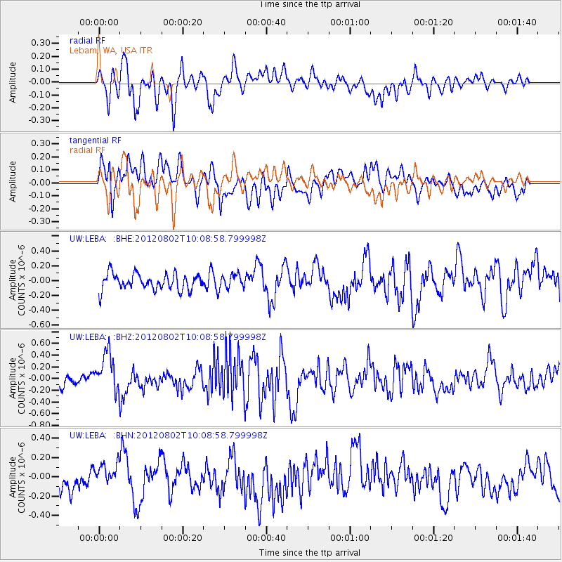
LEBA Lebam, WA, USA - Earthquake Result Viewer
*The percent match for this event was below the threshold and hence no stack was calculated.
| Earthquake location: |
New Ireland Region, P.N.G. |
| Earthquake latitude/longitude: |
-4.7/153.3 |
| Earthquake time(UTC): |
2012/08/02 (215) 09:56:41 GMT |
| Earthquake Depth: |
46 km |
| Earthquake Magnitude: |
5.8 MB, 5.7 MS, 6.1 MW, 6.1 MW |
| Earthquake Catalog/Contributor: |
WHDF/NEIC |
|
| Network: |
UW Pacific Northwest Regional Seismic Network |
| Station: |
LEBA Lebam, WA, USA |
| Lat/Lon: |
46.55 N/123.56 W |
| Elevation: |
73 m |
|
| Distance: |
88.6 deg |
| Az: |
43.274 deg |
| Baz: |
261.863 deg |
| Ray Param: |
$rayparam |
*The percent match for this event was below the threshold and hence was not used in the summary stack. |
|
| Radial Match: |
72.39032 % |
| Radial Bump: |
400 |
| Transverse Match: |
63.337627 % |
| Transverse Bump: |
400 |
| SOD ConfigId: |
469095 |
| Insert Time: |
2013-02-22 04:02:02.341 +0000 |
| GWidth: |
2.5 |
| Max Bumps: |
400 |
| Tol: |
0.001 |
|
Signal To Noise
| Channel | StoN | STA | LTA |
| UW:LEBA: :BHZ:20120802T10:08:58.799998Z | 2.7693052 | 3.5108147E-7 | 1.2677602E-7 |
| UW:LEBA: :BHN:20120802T10:08:58.799998Z | 1.3473177 | 1.3001707E-7 | 9.650068E-8 |
| UW:LEBA: :BHE:20120802T10:08:58.799998Z | 0.7927373 | 8.519069E-8 | 1.0746397E-7 |
| Arrivals |
| Ps | |
| PpPs | |
| PsPs/PpSs | |


