You are here: Home > Network List > GT - Global Telemetered Seismograph Network (USAF/USGS) Stations List
> Station PLCA Paso Flores, Argentina > Earthquake Result Viewer
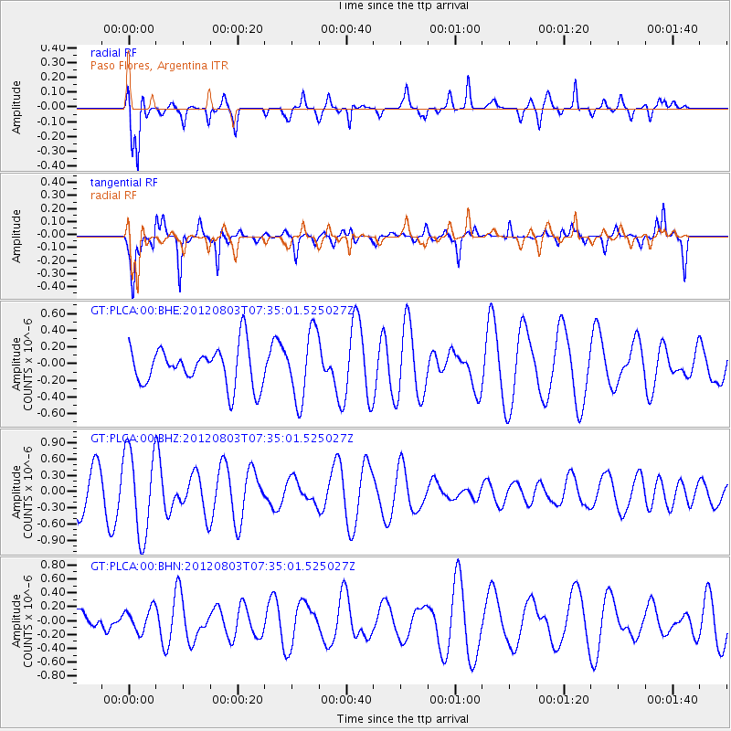
PLCA Paso Flores, Argentina - Earthquake Result Viewer
*The percent match for this event was below the threshold and hence no stack was calculated.
| Earthquake location: |
Fiji Islands Region |
| Earthquake latitude/longitude: |
-16.9/-176.9 |
| Earthquake time(UTC): |
2012/08/03 (216) 07:22:30 GMT |
| Earthquake Depth: |
20 km |
| Earthquake Magnitude: |
5.5 MW, 5.1 MS, 5.0 MB, 5.5 MW |
| Earthquake Catalog/Contributor: |
WHDF/NEIC |
|
| Network: |
GT Global Telemetered Seismograph Network (USAF/USGS) |
| Station: |
PLCA Paso Flores, Argentina |
| Lat/Lon: |
40.73 S/70.55 W |
| Elevation: |
1050 m |
|
| Distance: |
91.0 deg |
| Az: |
133.177 deg |
| Baz: |
246.723 deg |
| Ray Param: |
$rayparam |
*The percent match for this event was below the threshold and hence was not used in the summary stack. |
|
| Radial Match: |
71.86908 % |
| Radial Bump: |
371 |
| Transverse Match: |
74.72297 % |
| Transverse Bump: |
312 |
| SOD ConfigId: |
469095 |
| Insert Time: |
2013-02-22 04:06:01.423 +0000 |
| GWidth: |
2.5 |
| Max Bumps: |
400 |
| Tol: |
0.001 |
|
Signal To Noise
| Channel | StoN | STA | LTA |
| GT:PLCA:00:BHZ:20120803T07:35:01.525027Z | 2.6580958 | 7.963673E-7 | 2.9960069E-7 |
| GT:PLCA:00:BHN:20120803T07:35:01.525027Z | 1.1556029 | 1.6916204E-7 | 1.4638422E-7 |
| GT:PLCA:00:BHE:20120803T07:35:01.525027Z | 1.7555636 | 4.0944565E-7 | 2.3322747E-7 |
| Arrivals |
| Ps | |
| PpPs | |
| PsPs/PpSs | |


