You are here: Home > Network List > TA - USArray Transportable Network (new EarthScope stations) Stations List
> Station Q37A Longview Farm, Lee's Summit, MO, USA > Earthquake Result Viewer
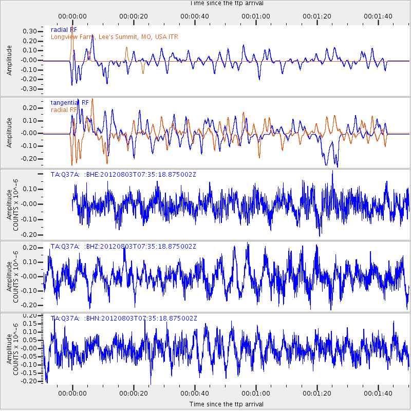
Q37A Longview Farm, Lee's Summit, MO, USA - Earthquake Result Viewer
*The percent match for this event was below the threshold and hence no stack was calculated.
| Earthquake location: |
Fiji Islands Region |
| Earthquake latitude/longitude: |
-16.9/-176.9 |
| Earthquake time(UTC): |
2012/08/03 (216) 07:22:30 GMT |
| Earthquake Depth: |
20 km |
| Earthquake Magnitude: |
5.5 MW, 5.1 MS, 5.0 MB, 5.5 MW |
| Earthquake Catalog/Contributor: |
WHDF/NEIC |
|
| Network: |
TA USArray Transportable Network (new EarthScope stations) |
| Station: |
Q37A Longview Farm, Lee's Summit, MO, USA |
| Lat/Lon: |
38.88 N/94.45 W |
| Elevation: |
297 m |
|
| Distance: |
94.7 deg |
| Az: |
50.94 deg |
| Baz: |
252.224 deg |
| Ray Param: |
$rayparam |
*The percent match for this event was below the threshold and hence was not used in the summary stack. |
|
| Radial Match: |
52.386658 % |
| Radial Bump: |
400 |
| Transverse Match: |
43.172333 % |
| Transverse Bump: |
400 |
| SOD ConfigId: |
469095 |
| Insert Time: |
2013-02-22 04:07:10.569 +0000 |
| GWidth: |
2.5 |
| Max Bumps: |
400 |
| Tol: |
0.001 |
|
Signal To Noise
| Channel | StoN | STA | LTA |
| TA:Q37A: :BHZ:20120803T07:35:18.875002Z | 1.049657 | 5.9345048E-8 | 5.6537566E-8 |
| TA:Q37A: :BHN:20120803T07:35:18.875002Z | 0.9223734 | 7.090718E-8 | 7.68747E-8 |
| TA:Q37A: :BHE:20120803T07:35:18.875002Z | 0.8318219 | 4.590903E-8 | 5.5190934E-8 |
| Arrivals |
| Ps | |
| PpPs | |
| PsPs/PpSs | |


