You are here: Home > Network List > BK - Berkeley Digital Seismograph Network Stations List
> Station HUMO Hull Mountain, OR > Earthquake Result Viewer
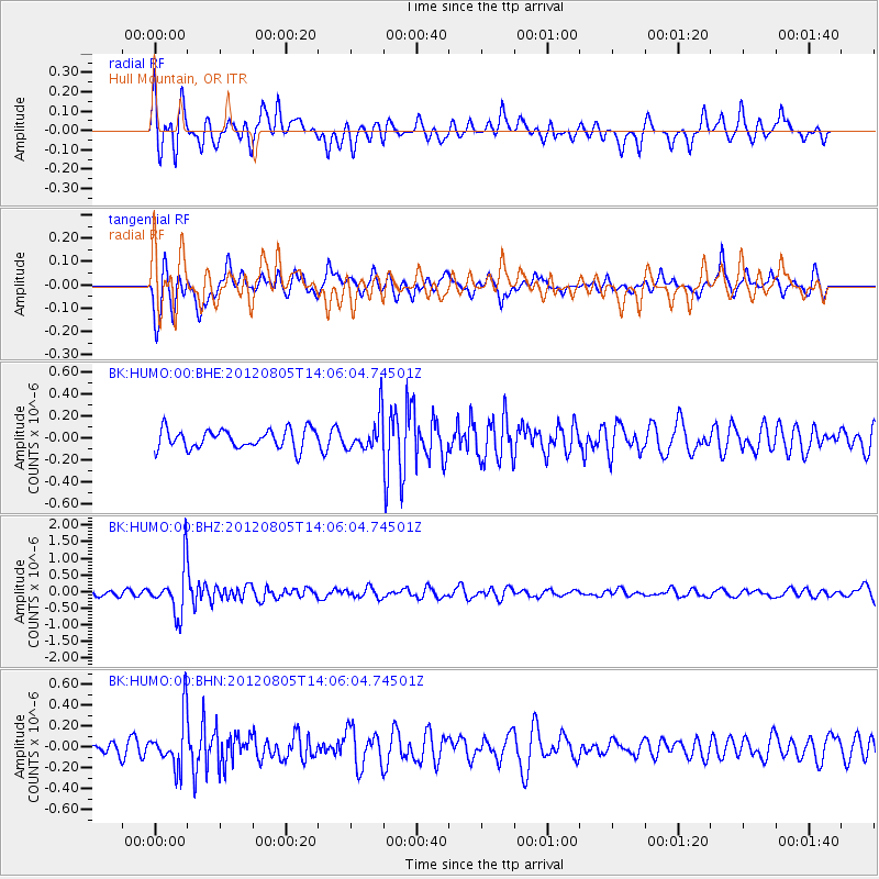
HUMO Hull Mountain, OR - Earthquake Result Viewer
*The percent match for this event was below the threshold and hence no stack was calculated.
| Earthquake location: |
Fiji Islands Region |
| Earthquake latitude/longitude: |
-21.1/-178.4 |
| Earthquake time(UTC): |
2012/08/05 (218) 13:55:10 GMT |
| Earthquake Depth: |
484 km |
| Earthquake Magnitude: |
5.5 MB, 5.8 MW, 5.9 MW |
| Earthquake Catalog/Contributor: |
WHDF/NEIC |
|
| Network: |
BK Berkeley Digital Seismograph Network |
| Station: |
HUMO Hull Mountain, OR |
| Lat/Lon: |
42.61 N/122.96 W |
| Elevation: |
555 m |
|
| Distance: |
81.4 deg |
| Az: |
37.923 deg |
| Baz: |
230.995 deg |
| Ray Param: |
$rayparam |
*The percent match for this event was below the threshold and hence was not used in the summary stack. |
|
| Radial Match: |
71.19074 % |
| Radial Bump: |
400 |
| Transverse Match: |
65.571754 % |
| Transverse Bump: |
400 |
| SOD ConfigId: |
469095 |
| Insert Time: |
2013-02-22 04:14:48.626 +0000 |
| GWidth: |
2.5 |
| Max Bumps: |
400 |
| Tol: |
0.001 |
|
Signal To Noise
| Channel | StoN | STA | LTA |
| BK:HUMO:00:BHZ:20120805T14:06:04.74501Z | 5.797294 | 7.111332E-7 | 1.226664E-7 |
| BK:HUMO:00:BHN:20120805T14:06:04.74501Z | 3.2961416 | 2.4679792E-7 | 7.48748E-8 |
| BK:HUMO:00:BHE:20120805T14:06:04.74501Z | 1.8092524 | 1.5769814E-7 | 8.716204E-8 |
| Arrivals |
| Ps | |
| PpPs | |
| PsPs/PpSs | |


