You are here: Home > Network List > CI - Caltech Regional Seismic Network Stations List
> Station FUR Furnace Creek, CA, USA > Earthquake Result Viewer
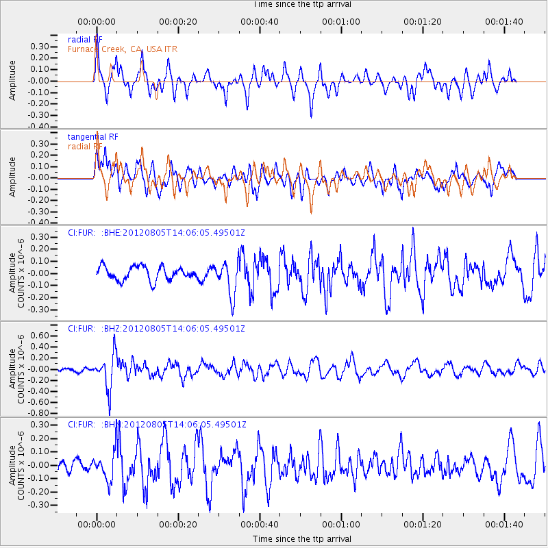
FUR Furnace Creek, CA, USA - Earthquake Result Viewer
*The percent match for this event was below the threshold and hence no stack was calculated.
| Earthquake location: |
Fiji Islands Region |
| Earthquake latitude/longitude: |
-21.1/-178.4 |
| Earthquake time(UTC): |
2012/08/05 (218) 13:55:10 GMT |
| Earthquake Depth: |
484 km |
| Earthquake Magnitude: |
5.5 MB, 5.8 MW, 5.9 MW |
| Earthquake Catalog/Contributor: |
WHDF/NEIC |
|
| Network: |
CI Caltech Regional Seismic Network |
| Station: |
FUR Furnace Creek, CA, USA |
| Lat/Lon: |
36.47 N/116.86 W |
| Elevation: |
-37.0 m |
|
| Distance: |
81.6 deg |
| Az: |
45.737 deg |
| Baz: |
236.025 deg |
| Ray Param: |
$rayparam |
*The percent match for this event was below the threshold and hence was not used in the summary stack. |
|
| Radial Match: |
62.25663 % |
| Radial Bump: |
350 |
| Transverse Match: |
63.97722 % |
| Transverse Bump: |
400 |
| SOD ConfigId: |
469095 |
| Insert Time: |
2013-02-22 04:16:58.605 +0000 |
| GWidth: |
2.5 |
| Max Bumps: |
400 |
| Tol: |
0.001 |
|
Signal To Noise
| Channel | StoN | STA | LTA |
| CI:FUR: :BHZ:20120805T14:06:05.49501Z | 6.883138 | 3.1993736E-7 | 4.6481322E-8 |
| CI:FUR: :BHN:20120805T14:06:05.49501Z | 2.7514126 | 1.1477568E-7 | 4.1715182E-8 |
| CI:FUR: :BHE:20120805T14:06:05.49501Z | 2.6046846 | 1.4613205E-7 | 5.6103552E-8 |
| Arrivals |
| Ps | |
| PpPs | |
| PsPs/PpSs | |


