You are here: Home > Network List > CI - Caltech Regional Seismic Network Stations List
> Station MPM Manuel Prospect Mine, California, USA > Earthquake Result Viewer
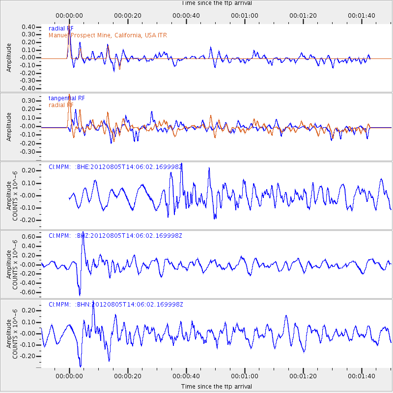
MPM Manuel Prospect Mine, California, USA - Earthquake Result Viewer
*The percent match for this event was below the threshold and hence no stack was calculated.
| Earthquake location: |
Fiji Islands Region |
| Earthquake latitude/longitude: |
-21.1/-178.4 |
| Earthquake time(UTC): |
2012/08/05 (218) 13:55:10 GMT |
| Earthquake Depth: |
484 km |
| Earthquake Magnitude: |
5.5 MB, 5.8 MW, 5.9 MW |
| Earthquake Catalog/Contributor: |
WHDF/NEIC |
|
| Network: |
CI Caltech Regional Seismic Network |
| Station: |
MPM Manuel Prospect Mine, California, USA |
| Lat/Lon: |
36.06 N/117.49 W |
| Elevation: |
185 m |
|
| Distance: |
80.9 deg |
| Az: |
45.791 deg |
| Baz: |
235.665 deg |
| Ray Param: |
$rayparam |
*The percent match for this event was below the threshold and hence was not used in the summary stack. |
|
| Radial Match: |
60.607727 % |
| Radial Bump: |
363 |
| Transverse Match: |
70.29748 % |
| Transverse Bump: |
354 |
| SOD ConfigId: |
469095 |
| Insert Time: |
2013-02-22 04:17:21.101 +0000 |
| GWidth: |
2.5 |
| Max Bumps: |
400 |
| Tol: |
0.001 |
|
Signal To Noise
| Channel | StoN | STA | LTA |
| CI:MPM: :BHZ:20120805T14:06:02.169998Z | 3.4372778 | 3.1291282E-7 | 9.103507E-8 |
| CI:MPM: :BHN:20120805T14:06:02.169998Z | 1.9201051 | 1.2294146E-7 | 6.4028505E-8 |
| CI:MPM: :BHE:20120805T14:06:02.169998Z | 1.535762 | 9.235882E-8 | 6.013876E-8 |
| Arrivals |
| Ps | |
| PpPs | |
| PsPs/PpSs | |


