You are here: Home > Network List > CI - Caltech Regional Seismic Network Stations List
> Station MPP McPhearson Peak > Earthquake Result Viewer
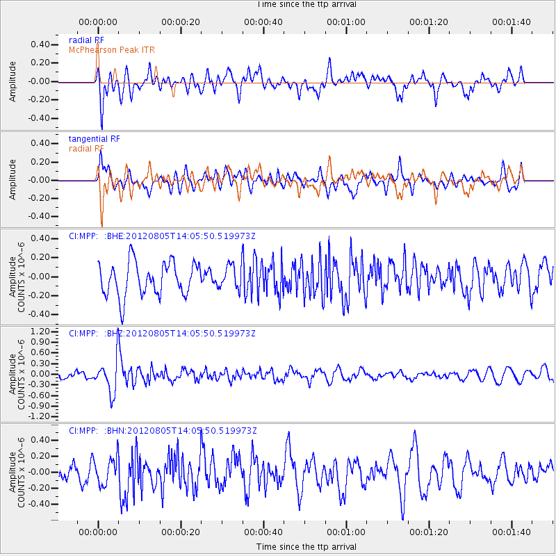
MPP McPhearson Peak - Earthquake Result Viewer
*The percent match for this event was below the threshold and hence no stack was calculated.
| Earthquake location: |
Fiji Islands Region |
| Earthquake latitude/longitude: |
-21.1/-178.4 |
| Earthquake time(UTC): |
2012/08/05 (218) 13:55:10 GMT |
| Earthquake Depth: |
484 km |
| Earthquake Magnitude: |
5.5 MB, 5.8 MW, 5.9 MW |
| Earthquake Catalog/Contributor: |
WHDF/NEIC |
|
| Network: |
CI Caltech Regional Seismic Network |
| Station: |
MPP McPhearson Peak |
| Lat/Lon: |
34.89 N/119.81 W |
| Elevation: |
1739 m |
|
| Distance: |
78.7 deg |
| Az: |
45.656 deg |
| Baz: |
234.297 deg |
| Ray Param: |
$rayparam |
*The percent match for this event was below the threshold and hence was not used in the summary stack. |
|
| Radial Match: |
63.548584 % |
| Radial Bump: |
400 |
| Transverse Match: |
63.63541 % |
| Transverse Bump: |
400 |
| SOD ConfigId: |
469095 |
| Insert Time: |
2013-02-22 04:18:14.097 +0000 |
| GWidth: |
2.5 |
| Max Bumps: |
400 |
| Tol: |
0.001 |
|
Signal To Noise
| Channel | StoN | STA | LTA |
| CI:MPP: :BHZ:20120805T14:05:50.519973Z | 4.437142 | 4.964488E-7 | 1.1188481E-7 |
| CI:MPP: :BHN:20120805T14:05:50.519973Z | 1.6088744 | 1.6813743E-7 | 1.0450625E-7 |
| CI:MPP: :BHE:20120805T14:05:50.519973Z | 0.75167465 | 1.3206376E-7 | 1.756927E-7 |
| Arrivals |
| Ps | |
| PpPs | |
| PsPs/PpSs | |


