You are here: Home > Network List > CN - Canadian National Seismograph Network Stations List
> Station INK INUVIK, NT > Earthquake Result Viewer
INK INUVIK, NT - Earthquake Result Viewer
*The percent match for this event was below the threshold and hence no stack was calculated.
| Earthquake location: |
Fiji Islands Region |
| Earthquake latitude/longitude: |
-21.1/-178.4 |
| Earthquake time(UTC): |
2012/08/05 (218) 13:55:10 GMT |
| Earthquake Depth: |
484 km |
| Earthquake Magnitude: |
5.5 MB, 5.8 MW, 5.9 MW |
| Earthquake Catalog/Contributor: |
WHDF/NEIC |
|
| Network: |
CN Canadian National Seismograph Network |
| Station: |
INK INUVIK, NT |
| Lat/Lon: |
68.31 N/133.53 W |
| Elevation: |
44 m |
|
| Distance: |
95.0 deg |
| Az: |
15.255 deg |
| Baz: |
221.347 deg |
| Ray Param: |
$rayparam |
*The percent match for this event was below the threshold and hence was not used in the summary stack. |
|
| Radial Match: |
40.26049 % |
| Radial Bump: |
400 |
| Transverse Match: |
46.390163 % |
| Transverse Bump: |
400 |
| SOD ConfigId: |
469095 |
| Insert Time: |
2013-02-22 04:19:29.006 +0000 |
| GWidth: |
2.5 |
| Max Bumps: |
400 |
| Tol: |
0.001 |
|
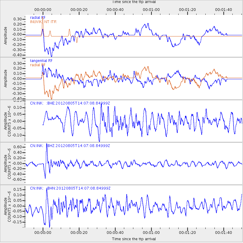
Signal To Noise
| Channel | StoN | STA | LTA |
| CN:INK: :BHZ:20120805T14:07:08.84999Z | 7.56558 | 2.898431E-7 | 3.8310755E-8 |
| CN:INK: :BHN:20120805T14:07:08.84999Z | 1.3101699 | 1.6107175E-7 | 1.229396E-7 |
| CN:INK: :BHE:20120805T14:07:08.84999Z | 1.7766479 | 7.502954E-8 | 4.2230955E-8 |
| Arrivals |
| Ps | |
| PpPs | |
| PsPs/PpSs | |


