You are here: Home > Network List > TA - USArray Transportable Network (new EarthScope stations) Stations List
> Station G03D McMinnville, OR, USA > Earthquake Result Viewer
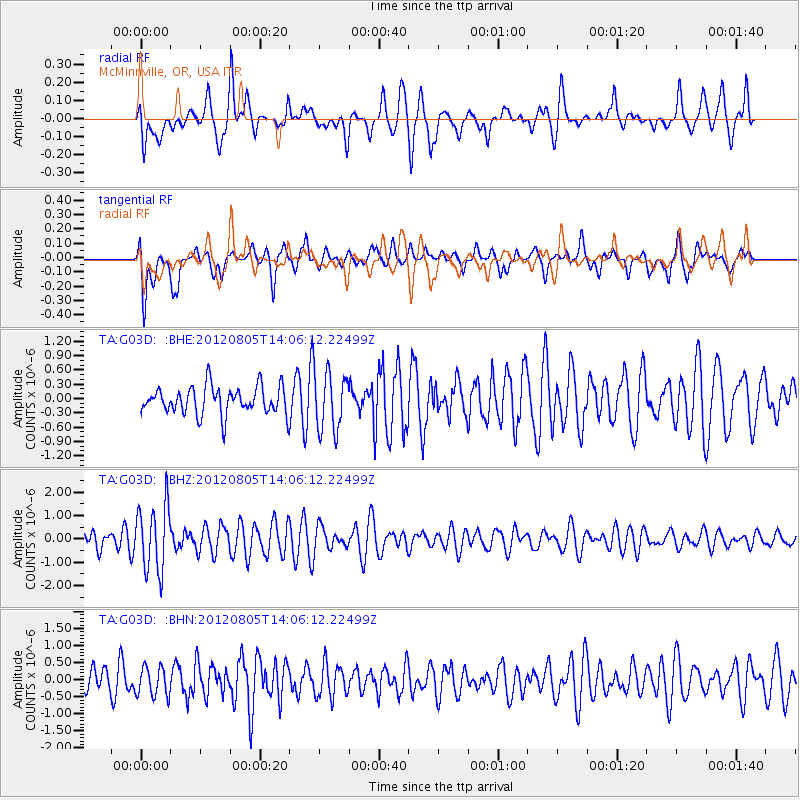
G03D McMinnville, OR, USA - Earthquake Result Viewer
*The percent match for this event was below the threshold and hence no stack was calculated.
| Earthquake location: |
Fiji Islands Region |
| Earthquake latitude/longitude: |
-21.1/-178.4 |
| Earthquake time(UTC): |
2012/08/05 (218) 13:55:10 GMT |
| Earthquake Depth: |
484 km |
| Earthquake Magnitude: |
5.5 MB, 5.8 MW, 5.9 MW |
| Earthquake Catalog/Contributor: |
WHDF/NEIC |
|
| Network: |
TA USArray Transportable Network (new EarthScope stations) |
| Station: |
G03D McMinnville, OR, USA |
| Lat/Lon: |
45.21 N/123.26 W |
| Elevation: |
222 m |
|
| Distance: |
82.9 deg |
| Az: |
35.746 deg |
| Baz: |
230.485 deg |
| Ray Param: |
$rayparam |
*The percent match for this event was below the threshold and hence was not used in the summary stack. |
|
| Radial Match: |
56.820972 % |
| Radial Bump: |
400 |
| Transverse Match: |
53.19542 % |
| Transverse Bump: |
400 |
| SOD ConfigId: |
469095 |
| Insert Time: |
2013-02-22 04:24:14.224 +0000 |
| GWidth: |
2.5 |
| Max Bumps: |
400 |
| Tol: |
0.001 |
|
Signal To Noise
| Channel | StoN | STA | LTA |
| TA:G03D: :BHZ:20120805T14:06:12.22499Z | 4.268702 | 1.4052077E-6 | 3.2918854E-7 |
| TA:G03D: :BHN:20120805T14:06:12.22499Z | 1.0066671 | 4.1992897E-7 | 4.1714776E-7 |
| TA:G03D: :BHE:20120805T14:06:12.22499Z | 2.0795684 | 6.072412E-7 | 2.9200348E-7 |
| Arrivals |
| Ps | |
| PpPs | |
| PsPs/PpSs | |


