You are here: Home > Network List > CN - Canadian National Seismograph Network Stations List
> Station INK INUVIK, NT > Earthquake Result Viewer
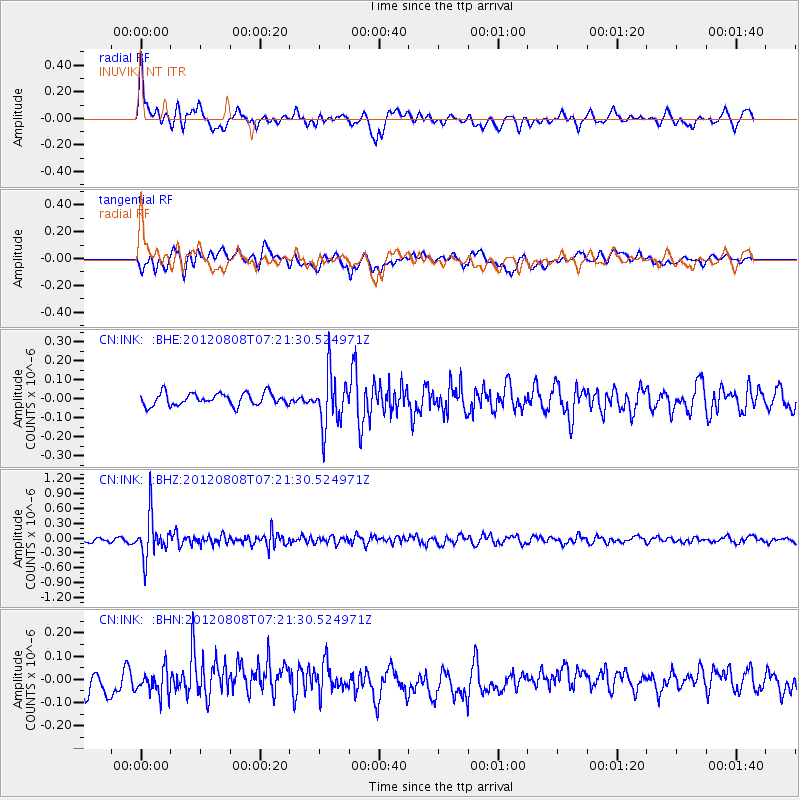
INK INUVIK, NT - Earthquake Result Viewer
*The percent match for this event was below the threshold and hence no stack was calculated.
| Earthquake location: |
Northeast Of Taiwan |
| Earthquake latitude/longitude: |
25.9/124.9 |
| Earthquake time(UTC): |
2012/08/08 (221) 07:11:01 GMT |
| Earthquake Depth: |
133 km |
| Earthquake Magnitude: |
5.5 MB, 5.4 MW, 5.4 MW |
| Earthquake Catalog/Contributor: |
WHDF/NEIC |
|
| Network: |
CN Canadian National Seismograph Network |
| Station: |
INK INUVIK, NT |
| Lat/Lon: |
68.31 N/133.53 W |
| Elevation: |
44 m |
|
| Distance: |
70.4 deg |
| Az: |
22.75 deg |
| Baz: |
290.435 deg |
| Ray Param: |
$rayparam |
*The percent match for this event was below the threshold and hence was not used in the summary stack. |
|
| Radial Match: |
70.80445 % |
| Radial Bump: |
400 |
| Transverse Match: |
53.11108 % |
| Transverse Bump: |
400 |
| SOD ConfigId: |
469095 |
| Insert Time: |
2013-02-22 04:33:26.837 +0000 |
| GWidth: |
2.5 |
| Max Bumps: |
400 |
| Tol: |
0.001 |
|
Signal To Noise
| Channel | StoN | STA | LTA |
| CN:INK: :BHZ:20120808T07:21:30.524971Z | 8.031929 | 4.238001E-7 | 5.276442E-8 |
| CN:INK: :BHN:20120808T07:21:30.524971Z | 1.3406888 | 5.113468E-8 | 3.8140602E-8 |
| CN:INK: :BHE:20120808T07:21:30.524971Z | 4.314208 | 1.3845897E-7 | 3.2093716E-8 |
| Arrivals |
| Ps | |
| PpPs | |
| PsPs/PpSs | |


