You are here: Home > Network List > UW - Pacific Northwest Regional Seismic Network Stations List
> Station MRBL Marblemount, WA, USA > Earthquake Result Viewer
MRBL Marblemount, WA, USA - Earthquake Result Viewer
*The percent match for this event was below the threshold and hence no stack was calculated.
| Earthquake location: |
Northeast Of Taiwan |
| Earthquake latitude/longitude: |
25.9/124.9 |
| Earthquake time(UTC): |
2012/08/08 (221) 07:11:01 GMT |
| Earthquake Depth: |
133 km |
| Earthquake Magnitude: |
5.5 MB, 5.4 MW, 5.4 MW |
| Earthquake Catalog/Contributor: |
WHDF/NEIC |
|
| Network: |
UW Pacific Northwest Regional Seismic Network |
| Station: |
MRBL Marblemount, WA, USA |
| Lat/Lon: |
48.52 N/121.48 W |
| Elevation: |
75 m |
|
| Distance: |
85.2 deg |
| Az: |
37.696 deg |
| Baz: |
304.05 deg |
| Ray Param: |
$rayparam |
*The percent match for this event was below the threshold and hence was not used in the summary stack. |
|
| Radial Match: |
64.87097 % |
| Radial Bump: |
400 |
| Transverse Match: |
68.658035 % |
| Transverse Bump: |
400 |
| SOD ConfigId: |
469095 |
| Insert Time: |
2013-02-22 04:38:07.197 +0000 |
| GWidth: |
2.5 |
| Max Bumps: |
400 |
| Tol: |
0.001 |
|
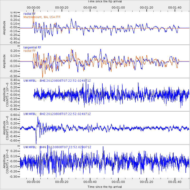
Signal To Noise
| Channel | StoN | STA | LTA |
| UW:MRBL: :BHZ:20120808T07:22:52.024971Z | 5.097701 | 2.505826E-7 | 4.9156E-8 |
| UW:MRBL: :BHN:20120808T07:22:52.024971Z | 1.4818046 | 1.0003233E-7 | 6.75071E-8 |
| UW:MRBL: :BHE:20120808T07:22:52.024971Z | 1.4269327 | 1.018858E-7 | 7.140197E-8 |
| Arrivals |
| Ps | |
| PpPs | |
| PsPs/PpSs | |


