You are here: Home > Network List > CI - Caltech Regional Seismic Network Stations List
> Station MPM Manuel Prospect Mine, California, USA > Earthquake Result Viewer
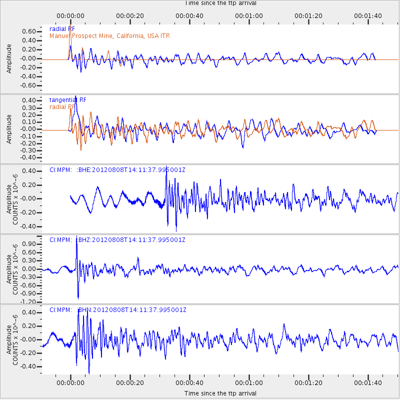
MPM Manuel Prospect Mine, California, USA - Earthquake Result Viewer
*The percent match for this event was below the threshold and hence no stack was calculated.
| Earthquake location: |
Alaska Peninsula |
| Earthquake latitude/longitude: |
54.9/-161.2 |
| Earthquake time(UTC): |
2012/08/08 (221) 14:05:17 GMT |
| Earthquake Depth: |
43 km |
| Earthquake Magnitude: |
5.6 MB, 5.2 MW, 5.1 MW |
| Earthquake Catalog/Contributor: |
WHDF/NEIC |
|
| Network: |
CI Caltech Regional Seismic Network |
| Station: |
MPM Manuel Prospect Mine, California, USA |
| Lat/Lon: |
36.06 N/117.49 W |
| Elevation: |
185 m |
|
| Distance: |
35.2 deg |
| Az: |
103.964 deg |
| Baz: |
316.206 deg |
| Ray Param: |
$rayparam |
*The percent match for this event was below the threshold and hence was not used in the summary stack. |
|
| Radial Match: |
68.830734 % |
| Radial Bump: |
400 |
| Transverse Match: |
70.31285 % |
| Transverse Bump: |
400 |
| SOD ConfigId: |
469095 |
| Insert Time: |
2013-02-22 04:44:12.055 +0000 |
| GWidth: |
2.5 |
| Max Bumps: |
400 |
| Tol: |
0.001 |
|
Signal To Noise
| Channel | StoN | STA | LTA |
| CI:MPM: :BHZ:20120808T14:11:37.995001Z | 5.291658 | 3.7928646E-7 | 7.16763E-8 |
| CI:MPM: :BHN:20120808T14:11:37.995001Z | 2.4280503 | 1.6901633E-7 | 6.9609904E-8 |
| CI:MPM: :BHE:20120808T14:11:37.995001Z | 2.086933 | 1.5492077E-7 | 7.4233704E-8 |
| Arrivals |
| Ps | |
| PpPs | |
| PsPs/PpSs | |


