You are here: Home > Network List > TA - USArray Transportable Network (new EarthScope stations) Stations List
> Station T57A Hurt, VA, USA > Earthquake Result Viewer
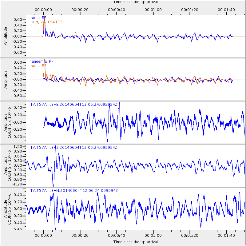
T57A Hurt, VA, USA - Earthquake Result Viewer
*The percent match for this event was below the threshold and hence no stack was calculated.
| Earthquake location: |
Southeastern Alaska |
| Earthquake latitude/longitude: |
59.0/-136.7 |
| Earthquake time(UTC): |
2014/06/04 (155) 11:58:58 GMT |
| Earthquake Depth: |
10 km |
| Earthquake Magnitude: |
5.7 MWP, 5.8 ML, 5.8 MI |
| Earthquake Catalog/Contributor: |
NEIC PDE/NEIC COMCAT |
|
| Network: |
TA USArray Transportable Network (new EarthScope stations) |
| Station: |
T57A Hurt, VA, USA |
| Lat/Lon: |
37.00 N/79.25 W |
| Elevation: |
230 m |
|
| Distance: |
42.6 deg |
| Az: |
94.991 deg |
| Baz: |
319.906 deg |
| Ray Param: |
$rayparam |
*The percent match for this event was below the threshold and hence was not used in the summary stack. |
|
| Radial Match: |
74.19689 % |
| Radial Bump: |
400 |
| Transverse Match: |
51.3224 % |
| Transverse Bump: |
400 |
| SOD ConfigId: |
3390531 |
| Insert Time: |
2019-04-12 04:09:31.713 +0000 |
| GWidth: |
2.5 |
| Max Bumps: |
400 |
| Tol: |
0.001 |
|
Signal To Noise
| Channel | StoN | STA | LTA |
| TA:T57A: :BHZ:20140604T12:06:24.099994Z | 1.7700485 | 2.7176202E-7 | 1.5353366E-7 |
| TA:T57A: :BHN:20140604T12:06:24.099994Z | 2.103478 | 1.8701519E-7 | 8.8907605E-8 |
| TA:T57A: :BHE:20140604T12:06:24.099994Z | 0.5712963 | 7.008792E-8 | 1.2268227E-7 |
| Arrivals |
| Ps | |
| PpPs | |
| PsPs/PpSs | |


