You are here: Home > Network List > TA - USArray Transportable Network (new EarthScope stations) Stations List
> Station SFIN Lafayette, IN, USA > Earthquake Result Viewer
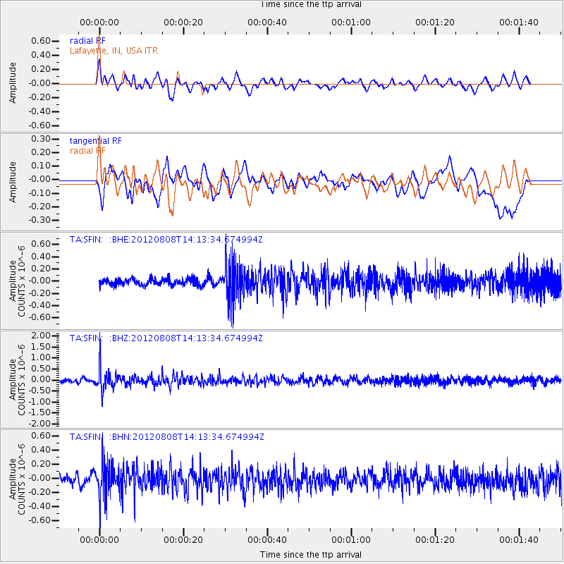
SFIN Lafayette, IN, USA - Earthquake Result Viewer
*The percent match for this event was below the threshold and hence no stack was calculated.
| Earthquake location: |
Alaska Peninsula |
| Earthquake latitude/longitude: |
54.9/-161.2 |
| Earthquake time(UTC): |
2012/08/08 (221) 14:05:17 GMT |
| Earthquake Depth: |
43 km |
| Earthquake Magnitude: |
5.6 MB, 5.2 MW, 5.1 MW |
| Earthquake Catalog/Contributor: |
WHDF/NEIC |
|
| Network: |
TA USArray Transportable Network (new EarthScope stations) |
| Station: |
SFIN Lafayette, IN, USA |
| Lat/Lon: |
40.38 N/87.10 W |
| Elevation: |
165 m |
|
| Distance: |
49.6 deg |
| Az: |
74.608 deg |
| Baz: |
313.171 deg |
| Ray Param: |
$rayparam |
*The percent match for this event was below the threshold and hence was not used in the summary stack. |
|
| Radial Match: |
63.075974 % |
| Radial Bump: |
400 |
| Transverse Match: |
44.686367 % |
| Transverse Bump: |
400 |
| SOD ConfigId: |
469095 |
| Insert Time: |
2013-02-22 04:54:56.441 +0000 |
| GWidth: |
2.5 |
| Max Bumps: |
400 |
| Tol: |
0.001 |
|
Signal To Noise
| Channel | StoN | STA | LTA |
| TA:SFIN: :BHZ:20120808T14:13:34.674994Z | 8.714733 | 4.9082547E-7 | 5.6321344E-8 |
| TA:SFIN: :BHN:20120808T14:13:34.674994Z | 4.038321 | 2.3909465E-7 | 5.9206453E-8 |
| TA:SFIN: :BHE:20120808T14:13:34.674994Z | 5.887771 | 3.1648324E-7 | 5.375264E-8 |
| Arrivals |
| Ps | |
| PpPs | |
| PsPs/PpSs | |


