You are here: Home > Network List > TA - USArray Transportable Network (new EarthScope stations) Stations List
> Station TPFO Pinon Flats, CA, USA > Earthquake Result Viewer
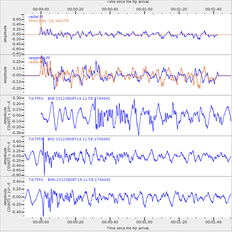
TPFO Pinon Flats, CA, USA - Earthquake Result Viewer
*The percent match for this event was below the threshold and hence no stack was calculated.
| Earthquake location: |
Alaska Peninsula |
| Earthquake latitude/longitude: |
54.9/-161.2 |
| Earthquake time(UTC): |
2012/08/08 (221) 14:05:17 GMT |
| Earthquake Depth: |
43 km |
| Earthquake Magnitude: |
5.6 MB, 5.2 MW, 5.1 MW |
| Earthquake Catalog/Contributor: |
WHDF/NEIC |
|
| Network: |
TA USArray Transportable Network (new EarthScope stations) |
| Station: |
TPFO Pinon Flats, CA, USA |
| Lat/Lon: |
33.61 N/116.45 W |
| Elevation: |
1275 m |
|
| Distance: |
37.6 deg |
| Az: |
105.711 deg |
| Baz: |
318.2 deg |
| Ray Param: |
$rayparam |
*The percent match for this event was below the threshold and hence was not used in the summary stack. |
|
| Radial Match: |
65.99557 % |
| Radial Bump: |
400 |
| Transverse Match: |
66.96983 % |
| Transverse Bump: |
400 |
| SOD ConfigId: |
469095 |
| Insert Time: |
2013-02-22 04:55:49.673 +0000 |
| GWidth: |
2.5 |
| Max Bumps: |
400 |
| Tol: |
0.001 |
|
Signal To Noise
| Channel | StoN | STA | LTA |
| TA:TPFO: :BHZ:20120808T14:11:58.174994Z | 2.767608 | 2.8224375E-7 | 1.01981115E-7 |
| TA:TPFO: :BHN:20120808T14:11:58.174994Z | 1.686336 | 1.735444E-7 | 1.02912104E-7 |
| TA:TPFO: :BHE:20120808T14:11:58.174994Z | 1.5261208 | 1.6199421E-7 | 1.061477E-7 |
| Arrivals |
| Ps | |
| PpPs | |
| PsPs/PpSs | |


