You are here: Home > Network List > TA - USArray Transportable Network (new EarthScope stations) Stations List
> Station K36A Gilmore City, IA, USA > Earthquake Result Viewer
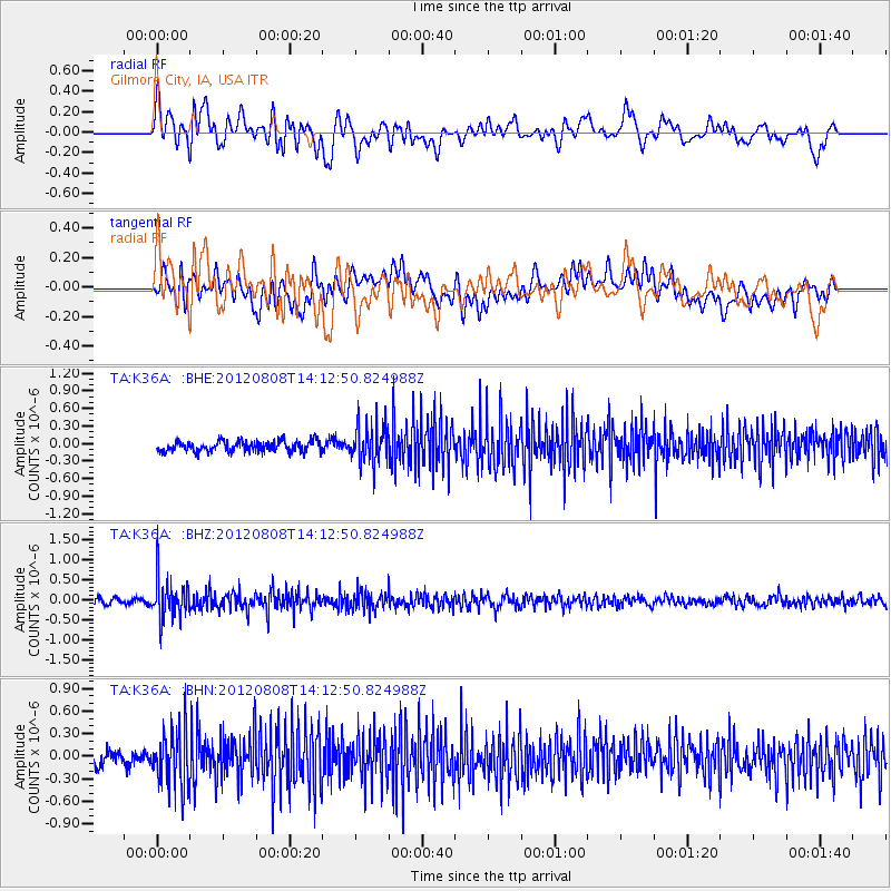
K36A Gilmore City, IA, USA - Earthquake Result Viewer
*The percent match for this event was below the threshold and hence no stack was calculated.
| Earthquake location: |
Alaska Peninsula |
| Earthquake latitude/longitude: |
54.9/-161.2 |
| Earthquake time(UTC): |
2012/08/08 (221) 14:05:17 GMT |
| Earthquake Depth: |
43 km |
| Earthquake Magnitude: |
5.6 MB, 5.2 MW, 5.1 MW |
| Earthquake Catalog/Contributor: |
WHDF/NEIC |
|
| Network: |
TA USArray Transportable Network (new EarthScope stations) |
| Station: |
K36A Gilmore City, IA, USA |
| Lat/Lon: |
42.64 N/94.45 W |
| Elevation: |
364 m |
|
| Distance: |
44.0 deg |
| Az: |
77.333 deg |
| Baz: |
310.178 deg |
| Ray Param: |
$rayparam |
*The percent match for this event was below the threshold and hence was not used in the summary stack. |
|
| Radial Match: |
63.73385 % |
| Radial Bump: |
400 |
| Transverse Match: |
59.668785 % |
| Transverse Bump: |
400 |
| SOD ConfigId: |
469095 |
| Insert Time: |
2013-02-22 04:57:23.789 +0000 |
| GWidth: |
2.5 |
| Max Bumps: |
400 |
| Tol: |
0.001 |
|
Signal To Noise
| Channel | StoN | STA | LTA |
| TA:K36A: :BHZ:20120808T14:12:50.824988Z | 5.9953485 | 4.9337905E-7 | 8.229364E-8 |
| TA:K36A: :BHN:20120808T14:12:50.824988Z | 4.264213 | 3.7561506E-7 | 8.8085436E-8 |
| TA:K36A: :BHE:20120808T14:12:50.824988Z | 3.6484854 | 3.3010443E-7 | 9.047711E-8 |
| Arrivals |
| Ps | |
| PpPs | |
| PsPs/PpSs | |


