You are here: Home > Network List > TA - USArray Transportable Network (new EarthScope stations) Stations List
> Station F39A Loretta, WI, USA > Earthquake Result Viewer
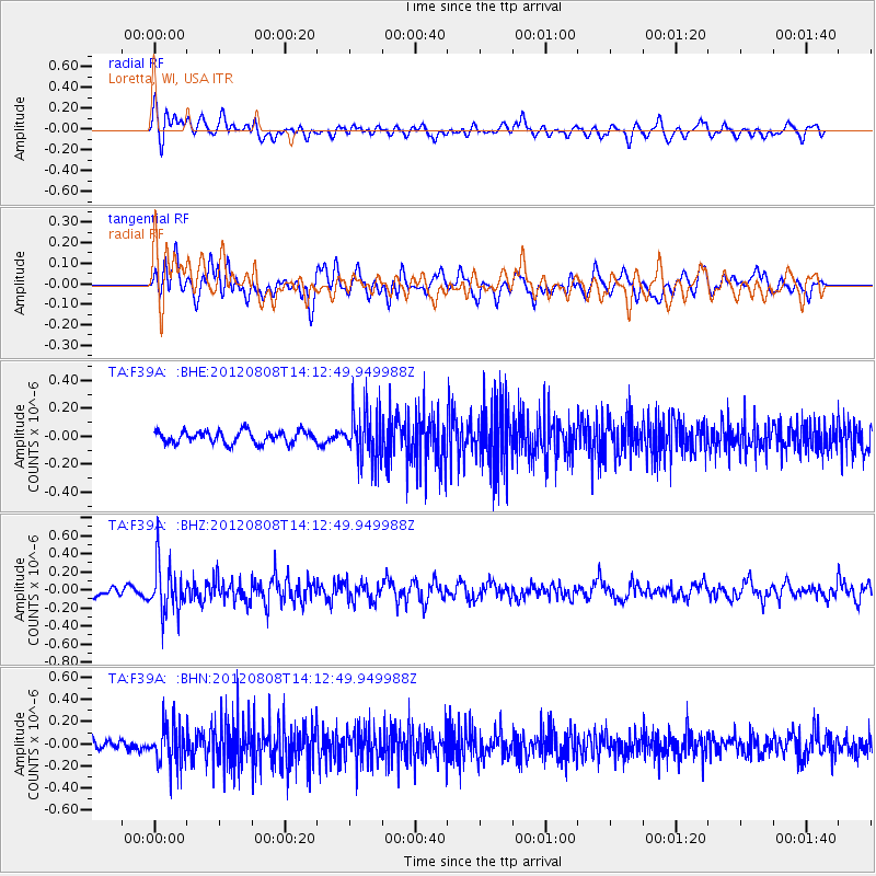
F39A Loretta, WI, USA - Earthquake Result Viewer
*The percent match for this event was below the threshold and hence no stack was calculated.
| Earthquake location: |
Alaska Peninsula |
| Earthquake latitude/longitude: |
54.9/-161.2 |
| Earthquake time(UTC): |
2012/08/08 (221) 14:05:17 GMT |
| Earthquake Depth: |
43 km |
| Earthquake Magnitude: |
5.6 MB, 5.2 MW, 5.1 MW |
| Earthquake Catalog/Contributor: |
WHDF/NEIC |
|
| Network: |
TA USArray Transportable Network (new EarthScope stations) |
| Station: |
F39A Loretta, WI, USA |
| Lat/Lon: |
45.92 N/90.92 W |
| Elevation: |
440 m |
|
| Distance: |
43.9 deg |
| Az: |
71.366 deg |
| Baz: |
308.34 deg |
| Ray Param: |
$rayparam |
*The percent match for this event was below the threshold and hence was not used in the summary stack. |
|
| Radial Match: |
61.06435 % |
| Radial Bump: |
400 |
| Transverse Match: |
58.53382 % |
| Transverse Bump: |
400 |
| SOD ConfigId: |
469095 |
| Insert Time: |
2013-02-22 05:09:54.019 +0000 |
| GWidth: |
2.5 |
| Max Bumps: |
400 |
| Tol: |
0.001 |
|
Signal To Noise
| Channel | StoN | STA | LTA |
| TA:F39A: :BHZ:20120808T14:12:49.949988Z | 5.554458 | 2.6969084E-7 | 4.8553943E-8 |
| TA:F39A: :BHN:20120808T14:12:49.949988Z | 4.21507 | 1.891396E-7 | 4.4872237E-8 |
| TA:F39A: :BHE:20120808T14:12:49.949988Z | 4.173937 | 1.8149558E-7 | 4.348307E-8 |
| Arrivals |
| Ps | |
| PpPs | |
| PsPs/PpSs | |


