You are here: Home > Network List > TA - USArray Transportable Network (new EarthScope stations) Stations List
> Station Y52A Lilburn, GA, USA > Earthquake Result Viewer
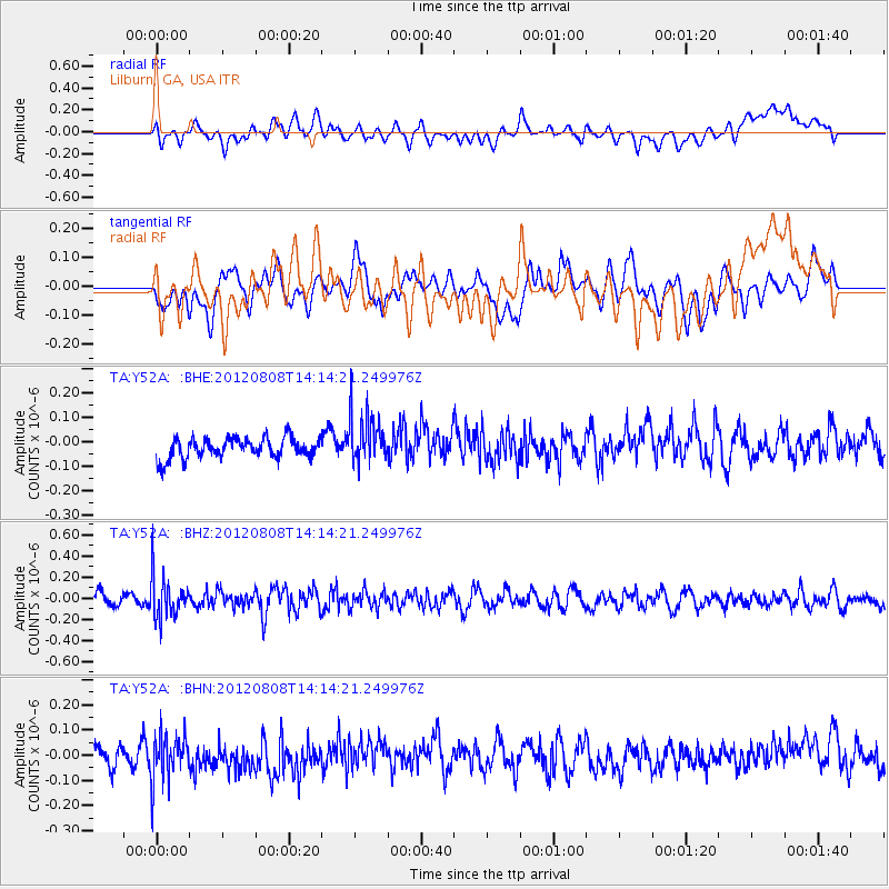
Y52A Lilburn, GA, USA - Earthquake Result Viewer
*The percent match for this event was below the threshold and hence no stack was calculated.
| Earthquake location: |
Alaska Peninsula |
| Earthquake latitude/longitude: |
54.9/-161.2 |
| Earthquake time(UTC): |
2012/08/08 (221) 14:05:17 GMT |
| Earthquake Depth: |
43 km |
| Earthquake Magnitude: |
5.6 MB, 5.2 MW, 5.1 MW |
| Earthquake Catalog/Contributor: |
WHDF/NEIC |
|
| Network: |
TA USArray Transportable Network (new EarthScope stations) |
| Station: |
Y52A Lilburn, GA, USA |
| Lat/Lon: |
33.86 N/84.06 W |
| Elevation: |
286 m |
|
| Distance: |
56.0 deg |
| Az: |
78.199 deg |
| Baz: |
317.172 deg |
| Ray Param: |
$rayparam |
*The percent match for this event was below the threshold and hence was not used in the summary stack. |
|
| Radial Match: |
32.709286 % |
| Radial Bump: |
400 |
| Transverse Match: |
45.971535 % |
| Transverse Bump: |
400 |
| SOD ConfigId: |
469095 |
| Insert Time: |
2013-02-22 05:18:58.582 +0000 |
| GWidth: |
2.5 |
| Max Bumps: |
400 |
| Tol: |
0.001 |
|
Signal To Noise
| Channel | StoN | STA | LTA |
| TA:Y52A: :BHZ:20120808T14:14:21.249976Z | 3.327069 | 1.9802712E-7 | 5.9519994E-8 |
| TA:Y52A: :BHN:20120808T14:14:21.249976Z | 1.6982342 | 9.536837E-8 | 5.6157376E-8 |
| TA:Y52A: :BHE:20120808T14:14:21.249976Z | 2.4990737 | 1.033829E-7 | 4.136849E-8 |
| Arrivals |
| Ps | |
| PpPs | |
| PsPs/PpSs | |


