You are here: Home > Network List > TA - USArray Transportable Network (new EarthScope stations) Stations List
> Station V50A Pikevile, TN, USA > Earthquake Result Viewer
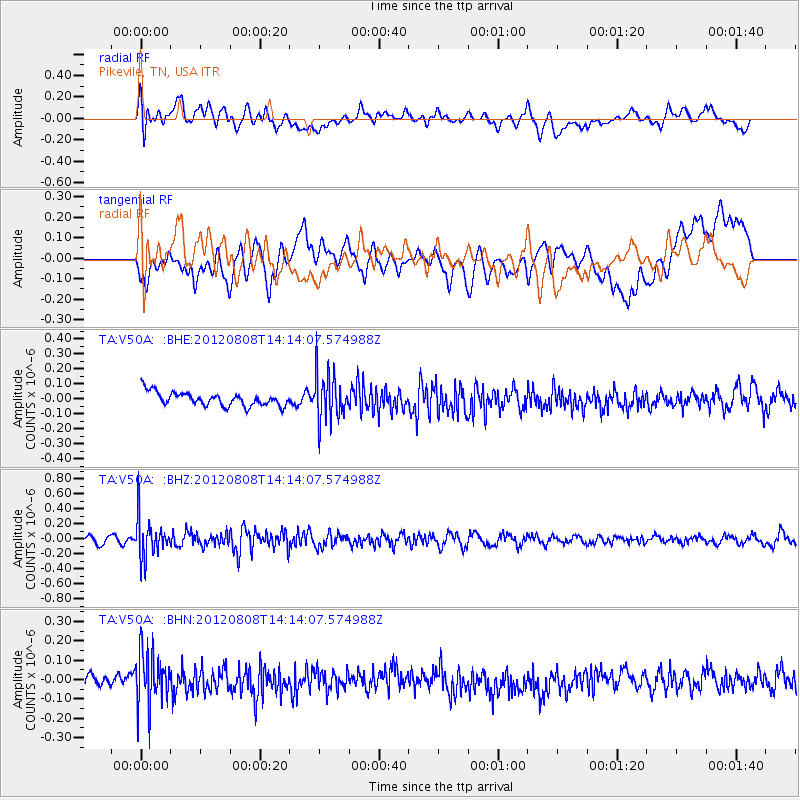
V50A Pikevile, TN, USA - Earthquake Result Viewer
*The percent match for this event was below the threshold and hence no stack was calculated.
| Earthquake location: |
Alaska Peninsula |
| Earthquake latitude/longitude: |
54.9/-161.2 |
| Earthquake time(UTC): |
2012/08/08 (221) 14:05:17 GMT |
| Earthquake Depth: |
43 km |
| Earthquake Magnitude: |
5.6 MB, 5.2 MW, 5.1 MW |
| Earthquake Catalog/Contributor: |
WHDF/NEIC |
|
| Network: |
TA USArray Transportable Network (new EarthScope stations) |
| Station: |
V50A Pikevile, TN, USA |
| Lat/Lon: |
35.67 N/85.10 W |
| Elevation: |
287 m |
|
| Distance: |
54.1 deg |
| Az: |
77.447 deg |
| Baz: |
316.152 deg |
| Ray Param: |
$rayparam |
*The percent match for this event was below the threshold and hence was not used in the summary stack. |
|
| Radial Match: |
53.30007 % |
| Radial Bump: |
400 |
| Transverse Match: |
52.72085 % |
| Transverse Bump: |
400 |
| SOD ConfigId: |
469095 |
| Insert Time: |
2013-02-22 05:19:58.555 +0000 |
| GWidth: |
2.5 |
| Max Bumps: |
400 |
| Tol: |
0.001 |
|
Signal To Noise
| Channel | StoN | STA | LTA |
| TA:V50A: :BHZ:20120808T14:14:07.574988Z | 5.3146367 | 2.5987404E-7 | 4.8897796E-8 |
| TA:V50A: :BHN:20120808T14:14:07.574988Z | 4.41232 | 1.4206185E-7 | 3.219663E-8 |
| TA:V50A: :BHE:20120808T14:14:07.574988Z | 3.4460979 | 1.5625399E-7 | 4.5342293E-8 |
| Arrivals |
| Ps | |
| PpPs | |
| PsPs/PpSs | |


