You are here: Home > Network List > CN - Canadian National Seismograph Network Stations List
> Station INK INUVIK, NT > Earthquake Result Viewer
INK INUVIK, NT - Earthquake Result Viewer
*The percent match for this event was below the threshold and hence no stack was calculated.
| Earthquake location: |
Revilla Gigedo Islands Region |
| Earthquake latitude/longitude: |
19.9/-109.3 |
| Earthquake time(UTC): |
2012/08/09 (222) 02:34:41 GMT |
| Earthquake Depth: |
10 km |
| Earthquake Magnitude: |
5.6 MW, 5.0 MS, 5.1 MB, 5.5 MW |
| Earthquake Catalog/Contributor: |
WHDF/NEIC |
|
| Network: |
CN Canadian National Seismograph Network |
| Station: |
INK INUVIK, NT |
| Lat/Lon: |
68.31 N/133.53 W |
| Elevation: |
44 m |
|
| Distance: |
50.7 deg |
| Az: |
348.639 deg |
| Baz: |
150.102 deg |
| Ray Param: |
$rayparam |
*The percent match for this event was below the threshold and hence was not used in the summary stack. |
|
| Radial Match: |
56.313065 % |
| Radial Bump: |
400 |
| Transverse Match: |
51.204006 % |
| Transverse Bump: |
400 |
| SOD ConfigId: |
469095 |
| Insert Time: |
2013-02-22 05:26:11.966 +0000 |
| GWidth: |
2.5 |
| Max Bumps: |
400 |
| Tol: |
0.001 |
|
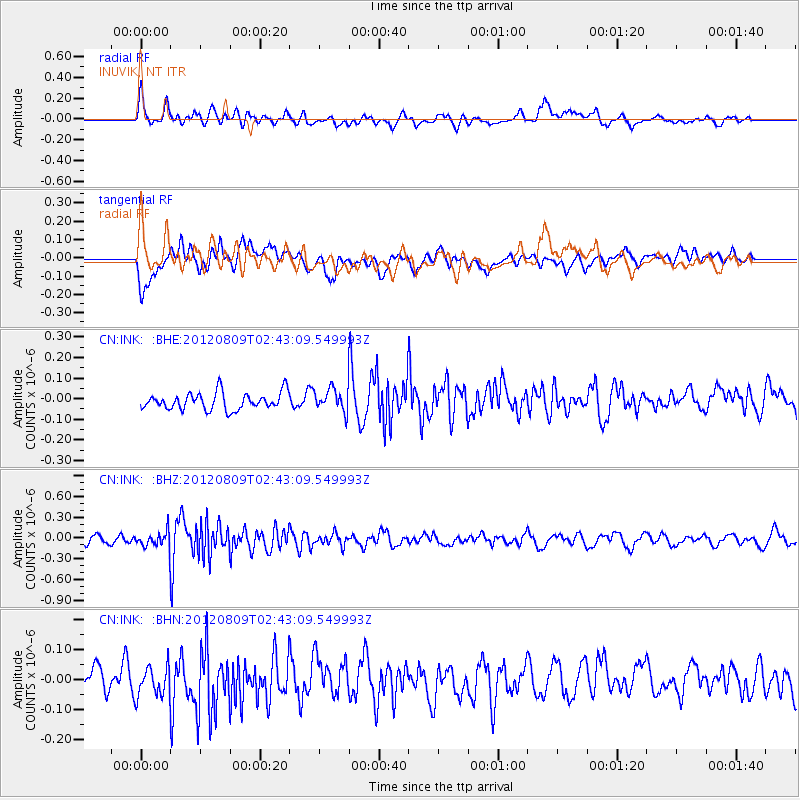
Signal To Noise
| Channel | StoN | STA | LTA |
| CN:INK: :BHZ:20120809T02:43:09.549993Z | 1.9884063 | 1.2024967E-7 | 6.04754E-8 |
| CN:INK: :BHN:20120809T02:43:09.549993Z | 0.62314177 | 4.850715E-8 | 7.7842884E-8 |
| CN:INK: :BHE:20120809T02:43:09.549993Z | 1.3258291 | 5.489443E-8 | 4.140385E-8 |
| Arrivals |
| Ps | |
| PpPs | |
| PsPs/PpSs | |


