You are here: Home > Network List > TA - USArray Transportable Network (new EarthScope stations) Stations List
> Station F40A Park Falls, WI, USA > Earthquake Result Viewer
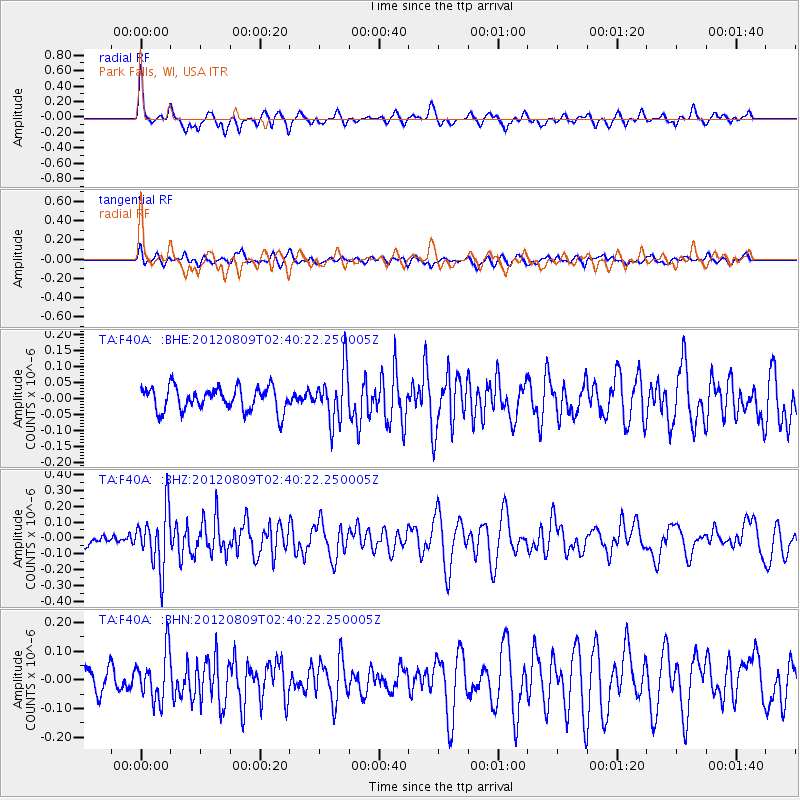
F40A Park Falls, WI, USA - Earthquake Result Viewer
*The percent match for this event was below the threshold and hence no stack was calculated.
| Earthquake location: |
Revilla Gigedo Islands Region |
| Earthquake latitude/longitude: |
19.9/-109.3 |
| Earthquake time(UTC): |
2012/08/09 (222) 02:34:41 GMT |
| Earthquake Depth: |
10 km |
| Earthquake Magnitude: |
5.6 MW, 5.0 MS, 5.1 MB, 5.5 MW |
| Earthquake Catalog/Contributor: |
WHDF/NEIC |
|
| Network: |
TA USArray Transportable Network (new EarthScope stations) |
| Station: |
F40A Park Falls, WI, USA |
| Lat/Lon: |
45.92 N/90.12 W |
| Elevation: |
486 m |
|
| Distance: |
30.3 deg |
| Az: |
27.039 deg |
| Baz: |
217.779 deg |
| Ray Param: |
$rayparam |
*The percent match for this event was below the threshold and hence was not used in the summary stack. |
|
| Radial Match: |
74.674255 % |
| Radial Bump: |
322 |
| Transverse Match: |
45.00536 % |
| Transverse Bump: |
400 |
| SOD ConfigId: |
469095 |
| Insert Time: |
2013-02-22 05:30:39.917 +0000 |
| GWidth: |
2.5 |
| Max Bumps: |
400 |
| Tol: |
0.001 |
|
Signal To Noise
| Channel | StoN | STA | LTA |
| TA:F40A: :BHZ:20120809T02:40:22.250005Z | 4.5162506 | 1.8295718E-7 | 4.0510855E-8 |
| TA:F40A: :BHN:20120809T02:40:22.250005Z | 1.6195877 | 8.277309E-8 | 5.110751E-8 |
| TA:F40A: :BHE:20120809T02:40:22.250005Z | 2.202275 | 8.1913434E-8 | 3.7194916E-8 |
| Arrivals |
| Ps | |
| PpPs | |
| PsPs/PpSs | |


