You are here: Home > Network List > TA - USArray Transportable Network (new EarthScope stations) Stations List
> Station M50A Fremont, OH, USA > Earthquake Result Viewer
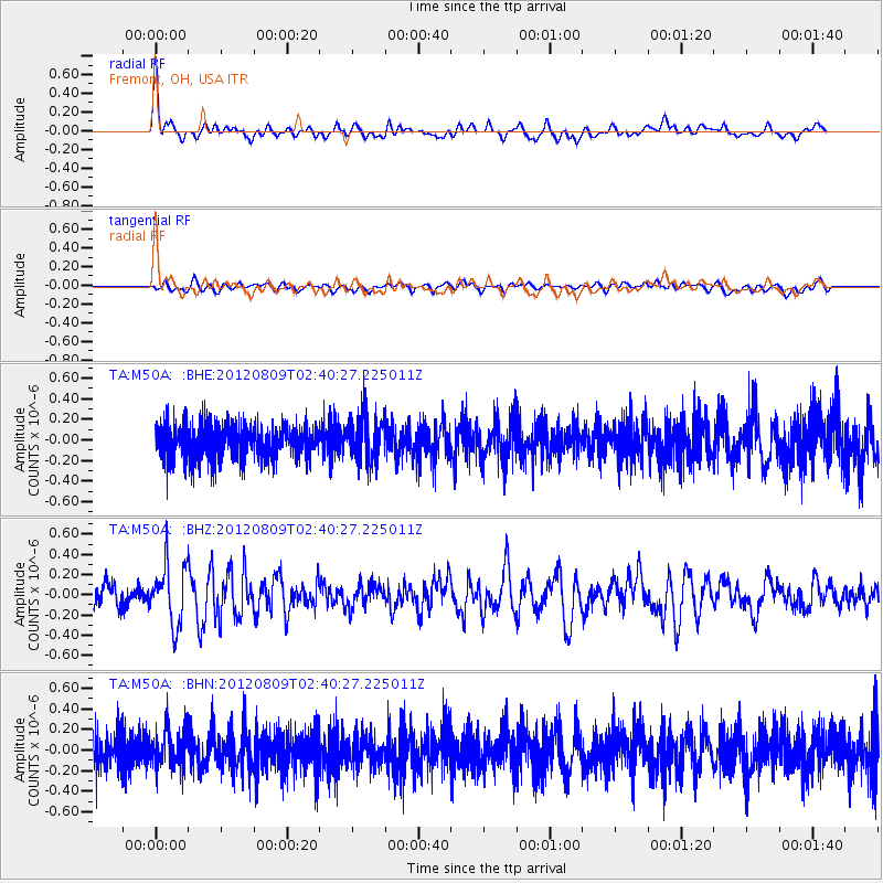
M50A Fremont, OH, USA - Earthquake Result Viewer
*The percent match for this event was below the threshold and hence no stack was calculated.
| Earthquake location: |
Revilla Gigedo Islands Region |
| Earthquake latitude/longitude: |
19.9/-109.3 |
| Earthquake time(UTC): |
2012/08/09 (222) 02:34:41 GMT |
| Earthquake Depth: |
10 km |
| Earthquake Magnitude: |
5.6 MW, 5.0 MS, 5.1 MB, 5.5 MW |
| Earthquake Catalog/Contributor: |
WHDF/NEIC |
|
| Network: |
TA USArray Transportable Network (new EarthScope stations) |
| Station: |
M50A Fremont, OH, USA |
| Lat/Lon: |
41.40 N/83.04 W |
| Elevation: |
176 m |
|
| Distance: |
30.9 deg |
| Az: |
40.428 deg |
| Baz: |
234.191 deg |
| Ray Param: |
$rayparam |
*The percent match for this event was below the threshold and hence was not used in the summary stack. |
|
| Radial Match: |
76.52954 % |
| Radial Bump: |
400 |
| Transverse Match: |
52.48386 % |
| Transverse Bump: |
400 |
| SOD ConfigId: |
469095 |
| Insert Time: |
2013-02-22 05:31:51.227 +0000 |
| GWidth: |
2.5 |
| Max Bumps: |
400 |
| Tol: |
0.001 |
|
Signal To Noise
| Channel | StoN | STA | LTA |
| TA:M50A: :BHZ:20120809T02:40:27.225011Z | 3.5672603 | 2.9677395E-7 | 8.31938E-8 |
| TA:M50A: :BHN:20120809T02:40:27.225011Z | 1.1096747 | 1.847537E-7 | 1.6649358E-7 |
| TA:M50A: :BHE:20120809T02:40:27.225011Z | 1.3418252 | 2.2180635E-7 | 1.6530197E-7 |
| Arrivals |
| Ps | |
| PpPs | |
| PsPs/PpSs | |


