MUR Murrieta - Earthquake Result Viewer
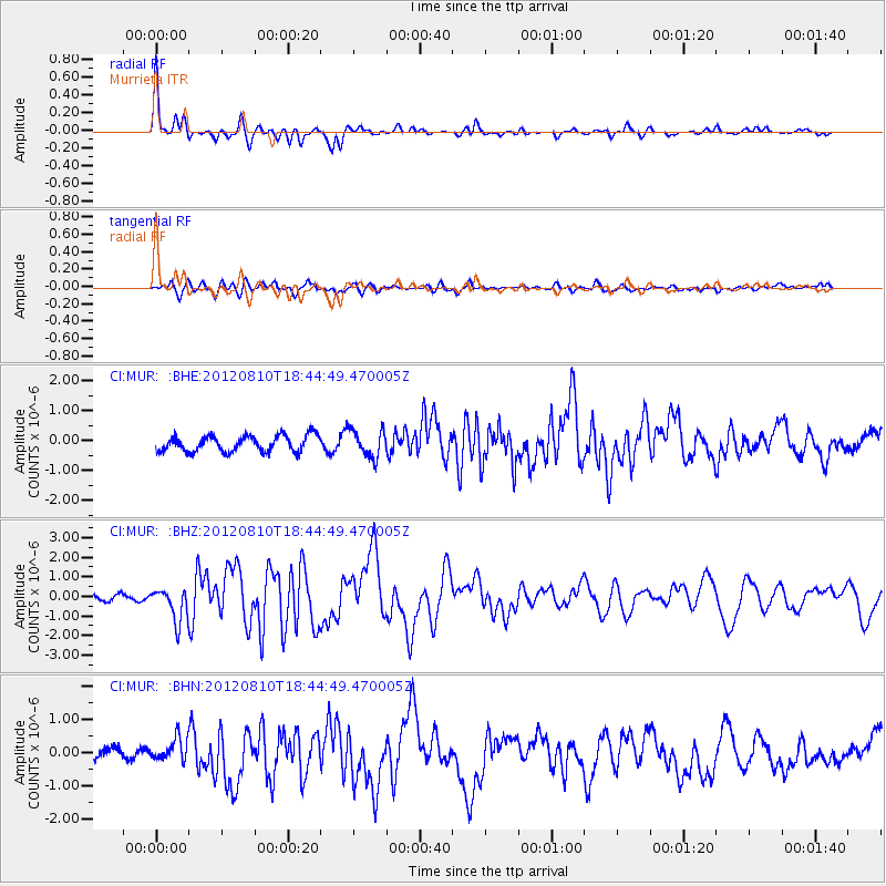
Earthquake location: Fox Islands, Aleutian Islands
Earthquake latitude/longitude: 52.6/-167.4
Earthquake time(UTC): 2012/08/10 (223) 18:37:43 GMT
Earthquake Depth: 13 km
Earthquake Magnitude: 5.9 MB, 6.2 MS, 6.2 MW, 6.2 MW
Earthquake Catalog/Contributor: WHDF/NEIC
Network: CI Caltech Regional Seismic Network
Station: MUR Murrieta
Lat/Lon: 33.60 N/117.20 W
Elevation: 562 m
Distance: 40.3 deg
Az: 97.777 deg
Baz: 313.653 deg
Ray Param: 0.07444421
Estimated Moho Depth: 41.0 km
Estimated Crust Vp/Vs: 1.62
Assumed Crust Vp: 6.264 km/s
Estimated Crust Vs: 3.86 km/s
Estimated Crust Poisson's Ratio: 0.19
Radial Match: 93.17239 %
Radial Bump: 343
Transverse Match: 62.585747 %
Transverse Bump: 400
SOD ConfigId: 469095
Insert Time: 2013-02-22 05:39:02.778 +0000
GWidth: 2.5
Max Bumps: 400
Tol: 0.001

Signal To Noise

ChannelStoNSTALTA
CI:MUR: :BHZ:20120810T18:44:49.470005Z6.85992158.509512E-71.2404679E-7
CI:MUR: :BHN:20120810T18:44:49.470005Z2.14688753.5096636E-71.6347683E-7
CI:MUR: :BHE:20120810T18:44:49.470005Z1.73851554.635611E-72.666419E-7
Arrivals
Ps4.4 SECOND
PpPs16 SECOND
PsPs/PpSs20 SECOND