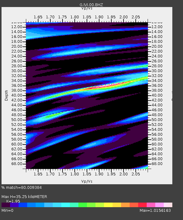
IVI Ivittuut, Greenland - Earthquake Result Viewer
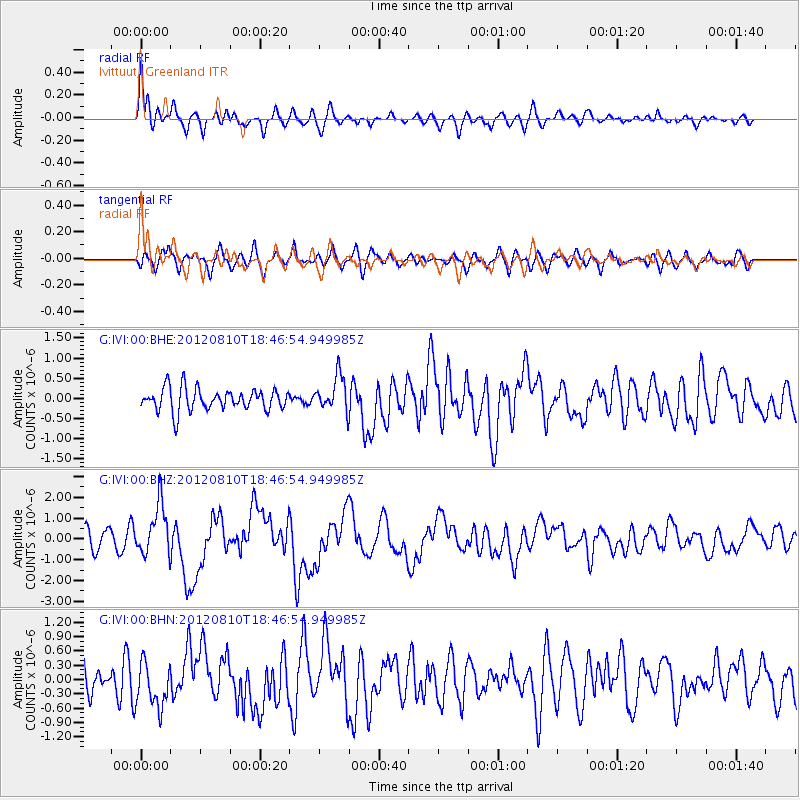
Earthquake location: Fox Islands, Aleutian Islands
Earthquake latitude/longitude: 52.6/-167.4
Earthquake time(UTC): 2012/08/10 (223) 18:37:43 GMT
Earthquake Depth: 13 km
Earthquake Magnitude: 5.9 MB, 6.2 MS, 6.2 MW, 6.2 MW
Earthquake Catalog/Contributor: WHDF/NEIC
Network: G GEOSCOPE
Station: IVI Ivittuut, Greenland
Lat/Lon: 61.21 N/48.17 W
Elevation: 15 m
Distance: 56.7 deg
Az: 30.371 deg
Baz: 320.47 deg
Ray Param: 0.06398474
Estimated Moho Depth: 35.25 km
Estimated Crust Vp/Vs: 1.95
Assumed Crust Vp: 6.472 km/s
Estimated Crust Vs: 3.319 km/s
Estimated Crust Poisson's Ratio: 0.32
Radial Match: 80.009384 %
Radial Bump: 400
Transverse Match: 54.091225 %
Transverse Bump: 400
SOD ConfigId: 469095
Insert Time: 2013-02-22 05:40:17.141 +0000
GWidth: 2.5
Max Bumps: 400
Tol: 0.001

Signal To Noise

ChannelStoNSTALTA
G:IVI:00:BHZ:20120810T18:46:54.949985Z2.52124671.2207255E-64.841753E-7
G:IVI:00:BHN:20120810T18:46:54.949985Z1.58650824.6796254E-72.9496385E-7
G:IVI:00:BHE:20120810T18:46:54.949985Z1.59362664.3255415E-72.7142752E-7
Arrivals
Ps5.4 SECOND
PpPs15 SECOND
PsPs/PpSs21 SECOND