K22A Casper, WY, USA - Earthquake Result Viewer
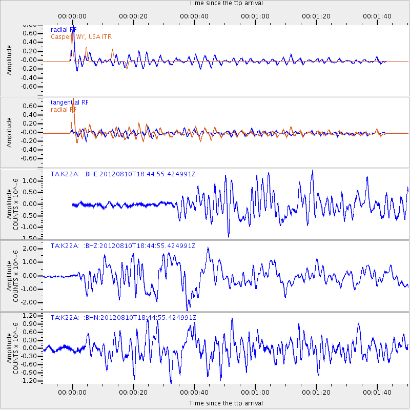
Earthquake location: Fox Islands, Aleutian Islands
Earthquake latitude/longitude: 52.6/-167.4
Earthquake time(UTC): 2012/08/10 (223) 18:37:43 GMT
Earthquake Depth: 13 km
Earthquake Magnitude: 5.9 MB, 6.2 MS, 6.2 MW, 6.2 MW
Earthquake Catalog/Contributor: WHDF/NEIC
Network: TA USArray Transportable Network (new EarthScope stations)
Station: K22A Casper, WY, USA
Lat/Lon: 42.65 N/106.52 W
Elevation: 1686 m
Distance: 41.1 deg
Az: 78.858 deg
Baz: 305.849 deg
Ray Param: 0.07401325
Estimated Moho Depth: 56.0 km
Estimated Crust Vp/Vs: 1.60
Assumed Crust Vp: 6.178 km/s
Estimated Crust Vs: 3.861 km/s
Estimated Crust Poisson's Ratio: 0.18
Radial Match: 93.05844 %
Radial Bump: 400
Transverse Match: 76.927475 %
Transverse Bump: 400
SOD ConfigId: 469095
Insert Time: 2013-02-22 05:49:38.002 +0000
GWidth: 2.5
Max Bumps: 400
Tol: 0.001

Signal To Noise

ChannelStoNSTALTA
TA:K22A: :BHZ:20120810T18:44:55.424991Z7.45463664.1937034E-75.6256308E-8
TA:K22A: :BHN:20120810T18:44:55.424991Z1.94838921.2084871E-76.202493E-8
TA:K22A: :BHE:20120810T18:44:55.424991Z2.08243751.1832507E-75.682047E-8
Arrivals
Ps5.8 SECOND
PpPs22 SECOND
PsPs/PpSs28 SECOND