
MDND Maddock, ND, USA - Earthquake Result Viewer
| ||||||||||||||||||
| ||||||||||||||||||
| ||||||||||||||||||
|
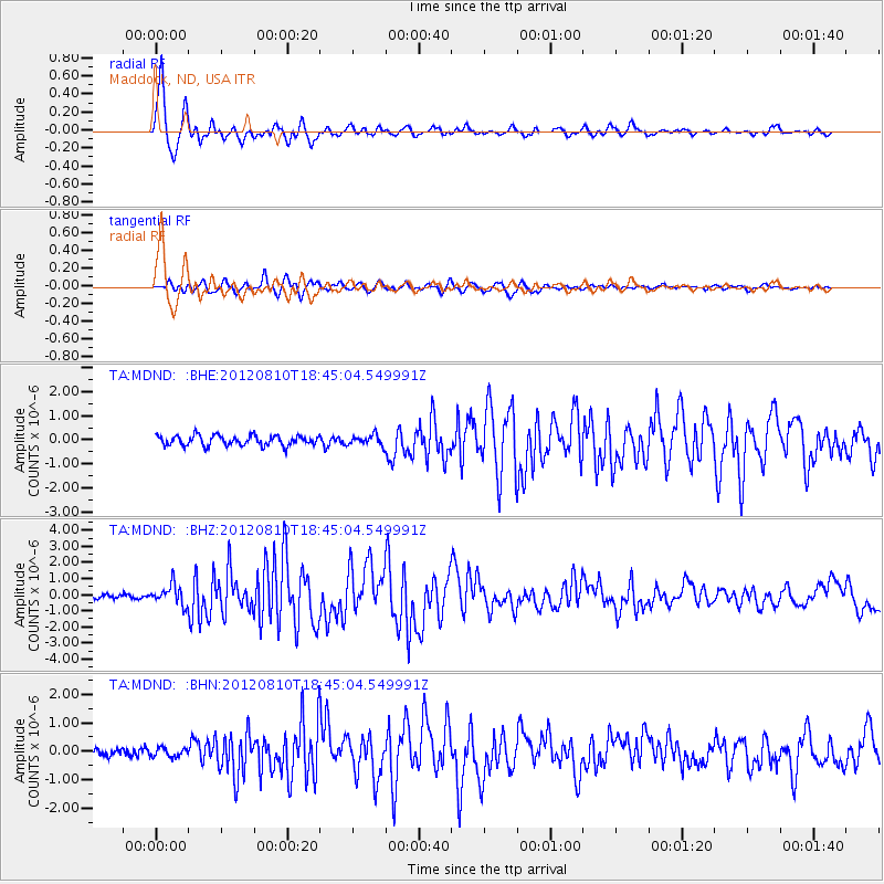
Signal To Noise
| Channel | StoN | STA | LTA |
| TA:MDND: :BHZ:20120810T18:45:04.549991Z | 5.2252593 | 6.04077E-7 | 1.1560709E-7 |
| TA:MDND: :BHN:20120810T18:45:04.549991Z | 1.0665927 | 1.6003929E-7 | 1.5004724E-7 |
| TA:MDND: :BHE:20120810T18:45:04.549991Z | 1.0473676 | 2.1912534E-7 | 2.0921533E-7 |
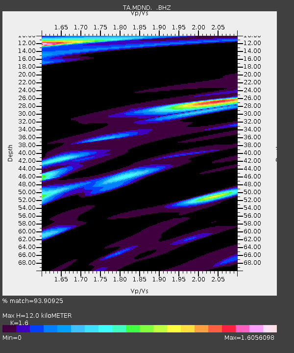
| Arrivals | |
| Ps | 1.2 SECOND |
| PpPs | 4.4 SECOND |
| PsPs/PpSs | 5.6 SECOND |

