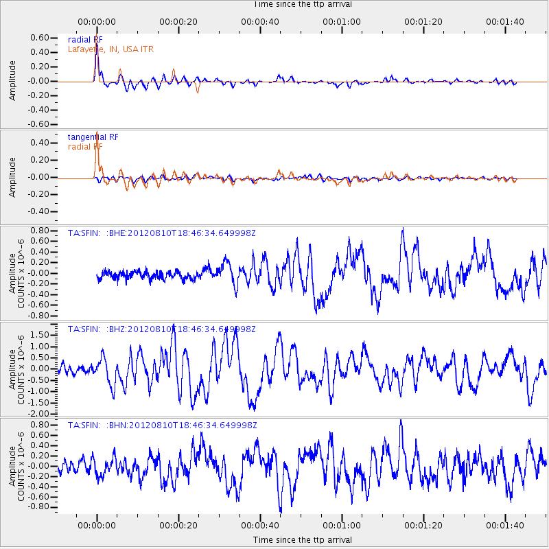
SFIN Lafayette, IN, USA - Earthquake Result Viewer
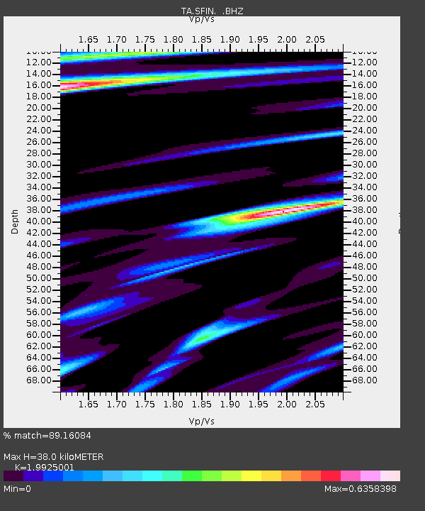
Earthquake location: Fox Islands, Aleutian Islands
Earthquake latitude/longitude: 52.6/-167.4
Earthquake time(UTC): 2012/08/10 (223) 18:37:43 GMT
Earthquake Depth: 13 km
Earthquake Magnitude: 5.9 MB, 6.2 MS, 6.2 MW, 6.2 MW
Earthquake Catalog/Contributor: WHDF/NEIC
Network: TA USArray Transportable Network (new EarthScope stations)
Station: SFIN Lafayette, IN, USA
Lat/Lon: 40.38 N/87.10 W
Elevation: 165 m
Distance: 53.9 deg
Az: 68.837 deg
Baz: 311.923 deg
Ray Param: 0.06581398
Estimated Moho Depth: 38.0 km
Estimated Crust Vp/Vs: 1.99
Assumed Crust Vp: 6.498 km/s
Estimated Crust Vs: 3.261 km/s
Estimated Crust Poisson's Ratio: 0.33
Radial Match: 89.16084 %
Radial Bump: 400
Transverse Match: 54.711826 %
Transverse Bump: 400
SOD ConfigId: 469095
Insert Time: 2013-02-22 05:49:50.790 +0000
GWidth: 2.5
Max Bumps: 400
Tol: 0.001

Signal To Noise

ChannelStoNSTALTA
TA:SFIN: :BHZ:20120810T18:46:34.649998Z3.49001176.073536E-71.7402624E-7
TA:SFIN: :BHN:20120810T18:46:34.649998Z1.5067941.7532322E-71.1635514E-7
TA:SFIN: :BHE:20120810T18:46:34.649998Z3.18036722.142694E-76.737253E-8
Arrivals
Ps6.1 SECOND
PpPs17 SECOND
PsPs/PpSs23 SECOND