
TUL1 Leonard, OK, USA - Earthquake Result Viewer
| ||||||||||||||||||
| ||||||||||||||||||
| ||||||||||||||||||
|
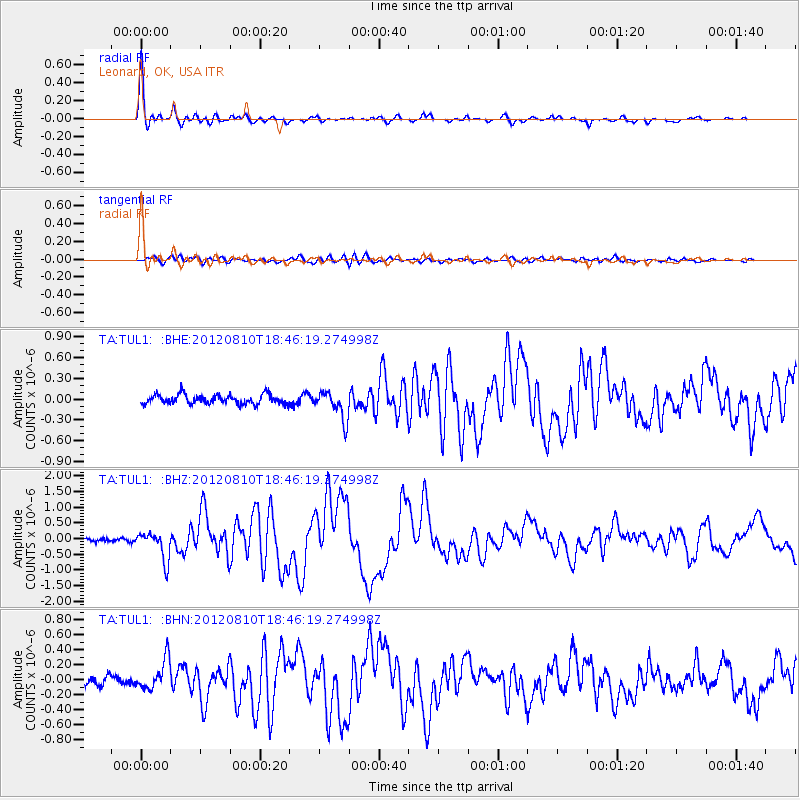
Signal To Noise
| Channel | StoN | STA | LTA |
| TA:TUL1: :BHZ:20120810T18:46:19.274998Z | 7.80609 | 4.5177615E-7 | 5.7874832E-8 |
| TA:TUL1: :BHN:20120810T18:46:19.274998Z | 3.5168579 | 2.0466332E-7 | 5.8194935E-8 |
| TA:TUL1: :BHE:20120810T18:46:19.274998Z | 3.0539086 | 2.0524476E-7 | 6.720723E-8 |
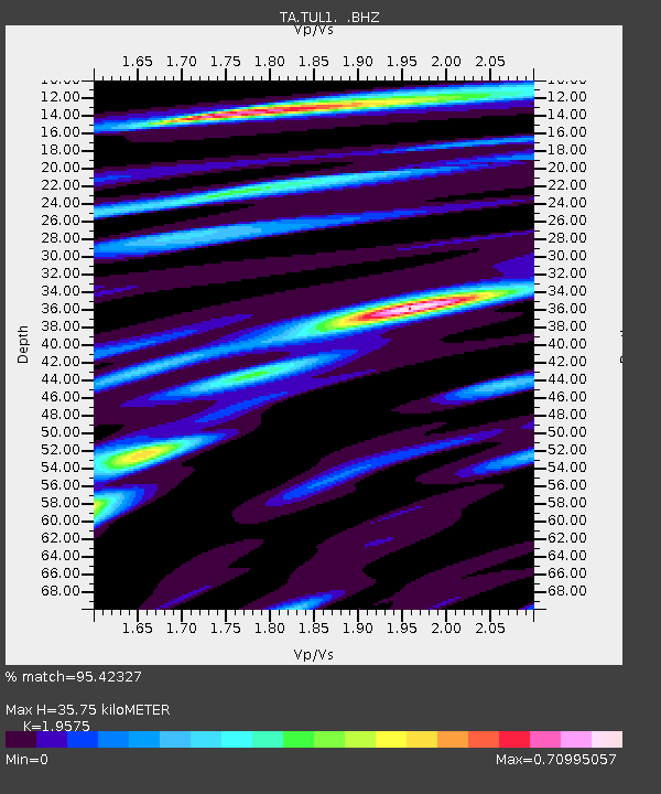
| Arrivals | |
| Ps | 5.5 SECOND |
| PpPs | 15 SECOND |
| PsPs/PpSs | 21 SECOND |

