BGNE Belgrade, NE, USA - Earthquake Result Viewer
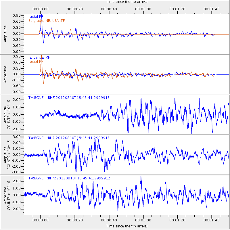
Earthquake location: Fox Islands, Aleutian Islands
Earthquake latitude/longitude: 52.6/-167.4
Earthquake time(UTC): 2012/08/10 (223) 18:37:43 GMT
Earthquake Depth: 13 km
Earthquake Magnitude: 5.9 MB, 6.2 MS, 6.2 MW, 6.2 MW
Earthquake Catalog/Contributor: WHDF/NEIC
Network: TA USArray Transportable Network (new EarthScope stations)
Station: BGNE Belgrade, NE, USA
Lat/Lon: 41.41 N/98.15 W
Elevation: 573 m
Distance: 46.8 deg
Az: 74.847 deg
Baz: 308.548 deg
Ray Param: 0.07041275
Estimated Moho Depth: 54.75 km
Estimated Crust Vp/Vs: 1.65
Assumed Crust Vp: 6.53 km/s
Estimated Crust Vs: 3.964 km/s
Estimated Crust Poisson's Ratio: 0.21
Radial Match: 92.82476 %
Radial Bump: 400
Transverse Match: 71.79321 %
Transverse Bump: 400
SOD ConfigId: 469095
Insert Time: 2013-02-22 05:50:02.640 +0000
GWidth: 2.5
Max Bumps: 400
Tol: 0.001

Signal To Noise

ChannelStoNSTALTA
TA:BGNE: :BHZ:20120810T18:45:41.299991Z6.08716256.0349134E-79.914165E-8
TA:BGNE: :BHN:20120810T18:45:41.299991Z1.3032563.6469416E-72.798331E-7
TA:BGNE: :BHE:20120810T18:45:41.299991Z0.99832512.347447E-72.3513854E-7
Arrivals
Ps5.8 SECOND
PpPs21 SECOND
PsPs/PpSs27 SECOND