J05D Fort Rock, OR, USA - Earthquake Result Viewer
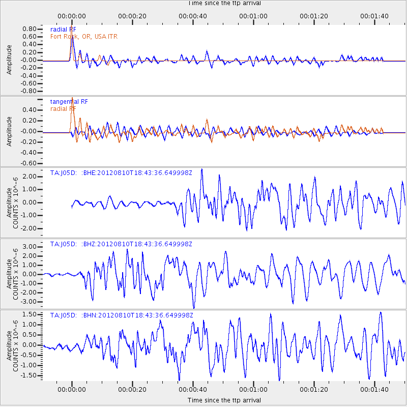
Earthquake location: Fox Islands, Aleutian Islands
Earthquake latitude/longitude: 52.6/-167.4
Earthquake time(UTC): 2012/08/10 (223) 18:37:43 GMT
Earthquake Depth: 13 km
Earthquake Magnitude: 5.9 MB, 6.2 MS, 6.2 MW, 6.2 MW
Earthquake Catalog/Contributor: WHDF/NEIC
Network: TA USArray Transportable Network (new EarthScope stations)
Station: J05D Fort Rock, OR, USA
Lat/Lon: 43.28 N/121.23 W
Elevation: 1541 m
Distance: 31.8 deg
Az: 88.306 deg
Baz: 303.46 deg
Ray Param: 0.078910865
Estimated Moho Depth: 30.5 km
Estimated Crust Vp/Vs: 2.01
Assumed Crust Vp: 6.597 km/s
Estimated Crust Vs: 3.286 km/s
Estimated Crust Poisson's Ratio: 0.33
Radial Match: 82.609955 %
Radial Bump: 400
Transverse Match: 70.23339 %
Transverse Bump: 400
SOD ConfigId: 469095
Insert Time: 2013-02-22 05:50:26.924 +0000
GWidth: 2.5
Max Bumps: 400
Tol: 0.001

Signal To Noise

ChannelStoNSTALTA
TA:J05D: :BHZ:20120810T18:43:36.649998Z3.6075084.3919144E-71.2174372E-7
TA:J05D: :BHN:20120810T18:43:36.649998Z1.24904371.9072077E-71.5269343E-7
TA:J05D: :BHE:20120810T18:43:36.649998Z0.88749671.753223E-71.9754698E-7
Arrivals
Ps5.0 SECOND
PpPs13 SECOND
PsPs/PpSs18 SECOND