N02D Trinity Center, CA, USA - Earthquake Result Viewer
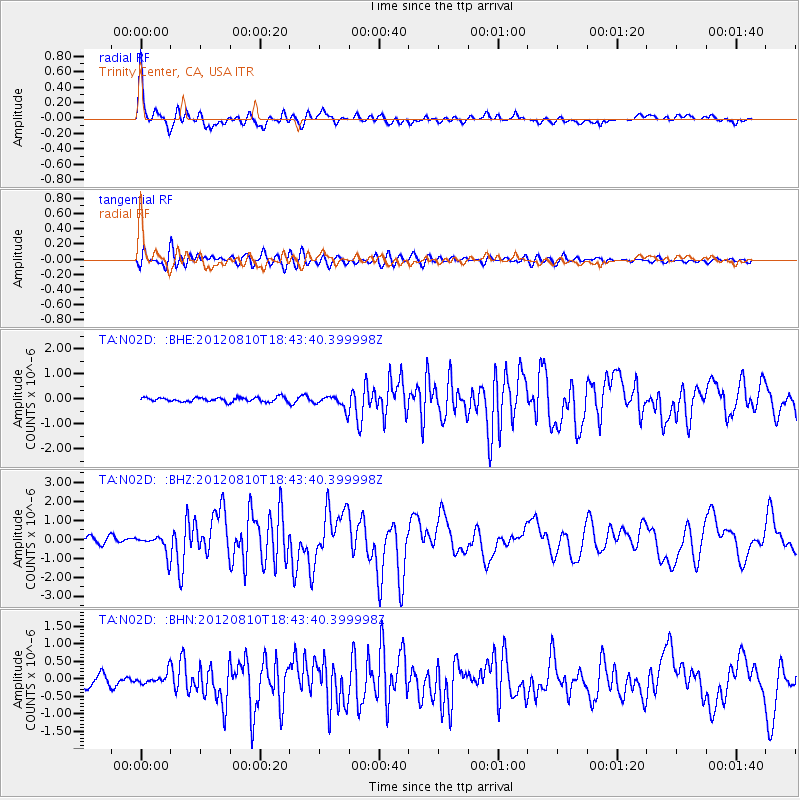
Earthquake location: Fox Islands, Aleutian Islands
Earthquake latitude/longitude: 52.6/-167.4
Earthquake time(UTC): 2012/08/10 (223) 18:37:43 GMT
Earthquake Depth: 13 km
Earthquake Magnitude: 5.9 MB, 6.2 MS, 6.2 MW, 6.2 MW
Earthquake Catalog/Contributor: WHDF/NEIC
Network: TA USArray Transportable Network (new EarthScope stations)
Station: N02D Trinity Center, CA, USA
Lat/Lon: 40.97 N/122.71 W
Elevation: 937 m
Distance: 32.2 deg
Az: 93.056 deg
Baz: 306.505 deg
Ray Param: 0.07872886
Estimated Moho Depth: 27.75 km
Estimated Crust Vp/Vs: 1.60
Assumed Crust Vp: 6.566 km/s
Estimated Crust Vs: 4.104 km/s
Estimated Crust Poisson's Ratio: 0.18
Radial Match: 88.81337 %
Radial Bump: 400
Transverse Match: 77.758194 %
Transverse Bump: 400
SOD ConfigId: 469095
Insert Time: 2013-02-22 05:50:38.514 +0000
GWidth: 2.5
Max Bumps: 400
Tol: 0.001

Signal To Noise

ChannelStoNSTALTA
TA:N02D: :BHZ:20120810T18:43:40.399998Z2.96039535.179472E-71.749588E-7
TA:N02D: :BHN:20120810T18:43:40.399998Z1.17900691.572378E-71.3336461E-7
TA:N02D: :BHE:20120810T18:43:40.399998Z3.14854342.697668E-78.567987E-8
Arrivals
Ps2.8 SECOND
PpPs10 SECOND
PsPs/PpSs13 SECOND