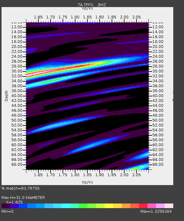
TPFO Pinon Flats, CA, USA - Earthquake Result Viewer
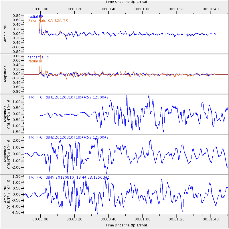
Earthquake location: Fox Islands, Aleutian Islands
Earthquake latitude/longitude: 52.6/-167.4
Earthquake time(UTC): 2012/08/10 (223) 18:37:43 GMT
Earthquake Depth: 13 km
Earthquake Magnitude: 5.9 MB, 6.2 MS, 6.2 MW, 6.2 MW
Earthquake Catalog/Contributor: WHDF/NEIC
Network: TA USArray Transportable Network (new EarthScope stations)
Station: TPFO Pinon Flats, CA, USA
Lat/Lon: 33.61 N/116.45 W
Elevation: 1275 m
Distance: 40.8 deg
Az: 97.115 deg
Baz: 313.557 deg
Ray Param: 0.074184425
Estimated Moho Depth: 31.0 km
Estimated Crust Vp/Vs: 1.62
Assumed Crust Vp: 6.264 km/s
Estimated Crust Vs: 3.855 km/s
Estimated Crust Poisson's Ratio: 0.20
Radial Match: 93.79755 %
Radial Bump: 366
Transverse Match: 74.28314 %
Transverse Bump: 400
SOD ConfigId: 469095
Insert Time: 2013-02-22 05:51:01.534 +0000
GWidth: 2.5
Max Bumps: 400
Tol: 0.001

Signal To Noise

ChannelStoNSTALTA
TA:TPFO: :BHZ:20120810T18:44:53.125004Z4.44883785.174243E-71.1630551E-7
TA:TPFO: :BHN:20120810T18:44:53.125004Z1.63347642.392025E-71.464377E-7
TA:TPFO: :BHE:20120810T18:44:53.125004Z2.33581612.197247E-79.406764E-8
Arrivals
Ps3.3 SECOND
PpPs12 SECOND
PsPs/PpSs15 SECOND