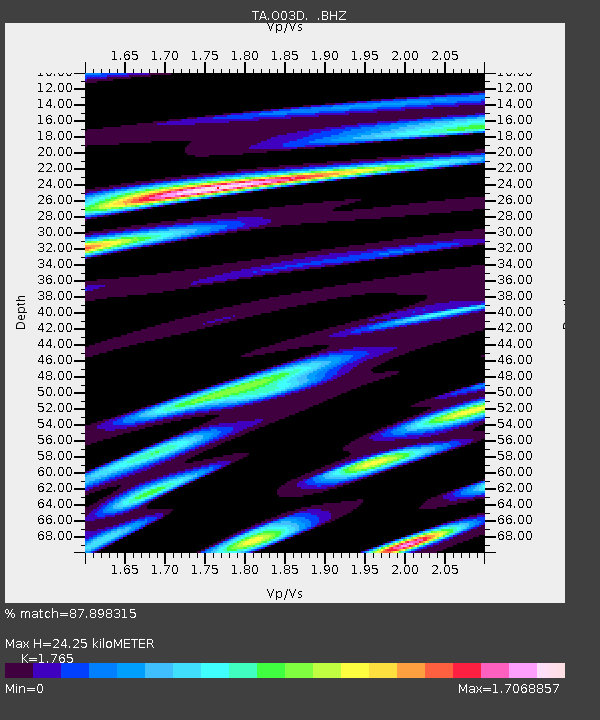
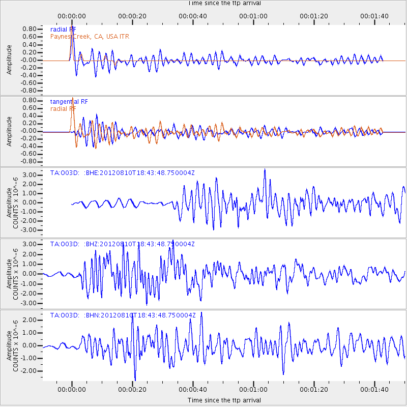
O03D Paynes Creek, CA, USA - Earthquake Result Viewer

Earthquake location: Fox Islands, Aleutian Islands
Earthquake latitude/longitude: 52.6/-167.4
Earthquake time(UTC): 2012/08/10 (223) 18:37:43 GMT
Earthquake Depth: 13 km
Earthquake Magnitude: 5.9 MB, 6.2 MS, 6.2 MW, 6.2 MW
Earthquake Catalog/Contributor: WHDF/NEIC
Network: TA USArray Transportable Network (new EarthScope stations)
Station: O03D Paynes Creek, CA, USA
Lat/Lon: 40.29 N/121.80 W
Elevation: 968 m
Distance: 33.2 deg
Az: 93.297 deg
Baz: 307.293 deg
Ray Param: 0.07831085
Estimated Moho Depth: 24.25 km
Estimated Crust Vp/Vs: 1.76
Assumed Crust Vp: 6.566 km/s
Estimated Crust Vs: 3.72 km/s
Estimated Crust Poisson's Ratio: 0.26
Radial Match: 87.898315 %
Radial Bump: 400
Transverse Match: 79.21012 %
Transverse Bump: 400
SOD ConfigId: 469095
Insert Time: 2013-02-22 05:51:22.380 +0000
GWidth: 2.5
Max Bumps: 400
Tol: 0.001

Signal To Noise

ChannelStoNSTALTA
TA:O03D: :BHZ:20120810T18:43:48.750004Z3.42007525.613141E-71.641233E-7
TA:O03D: :BHN:20120810T18:43:48.750004Z3.84900433.3796152E-78.780493E-8
TA:O03D: :BHE:20120810T18:43:48.750004Z0.88253212.3783942E-72.694966E-7
Arrivals
Ps3.1 SECOND
PpPs9.4 SECOND
PsPs/PpSs12 SECOND